
Use Multi-use | ||
 | ||
Length 15 mi (24 km) when completed Designation USBR 50 / State Bike Route 1 Trail difficulty Easy (fully accessible) | ||
Camp chase trail darby creek metropark west to wilson rd at 4x speed
The Camp Chase Trail is a paved multi-use trail in Madison and Franklin counties in the U.S. state of Ohio. It serves as the Southwest Columbus segment of the 330-mile (530 km) Ohio to Erie Trail. Bicyclists, hikers, runners, rollerbladers, and other groups such as bird watchers and nature lovers can explore the natural beauty of Central Ohio, as the trail weaves across the Capital City region. The entire length of the Camp Chase Trail is part of U.S. Bicycle Route 50, a west-east bicycle route across Ohio connecting Indiana to West Virginia.
Contents
- Camp chase trail darby creek metropark west to wilson rd at 4x speed
- Map of Camp Chase Trail Ohio USA
- Name
- Route
- Detailed route
- Communities adjacent to the trail
- Trailside amenities
- Local attractions
- Milestones
- Economic impact
- References
Map of Camp Chase Trail, Ohio, USA
Name
Camp Chase Trail is a "rail with trail" project, named for the Camp Chase Industrial Railroad it parallels. Camp Chase was a military staging and training camp for Union forces, and a prison camp for Confederates during the Civil War. All that remains of the camp today is a Confederate cemetery containing 2,260 graves, bordering Sullivant Ave. It was named for former Ohio Governor and Lincoln's Secretary of the Treasury Salmon P. Chase. Four future Presidents passed through Camp Chase as Union soldiers: Andrew Johnson, Rutherford B. Hayes, James Garfield, and William McKinley.
Route
The Camp Chase Trail is done, when fully complete it is 15 miles (24 km) total, with 3 miles (4.8 km) in Madison County and 12 miles (19 km) in Franklin County. The Camp Chase Trail extends from West of Lilly Chapel (Roberts Pass Trail) to Columbus Holton Park, with the trailhead in Battelle Darby Creek Metro Park as the midpoint.r
Detailed route
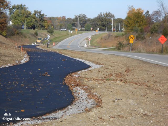
The Camp Chase Trail is complete from the conjunction with the Roberts Pass trail at the Wilson Road Trailhead in Madison County, Ohio to the intersection with Sullivant Avenue in Franklin County. The newest segment from Galloway Road to West Sullivant Ave is complete and opened in October 2015. City of Columbus approved funding for the final 3 miles of the Camp Chase Trail from Georgesville Road to N. Eureka Ave on November 3, 2014. From Trail end at Sullivant Ave, the Ohio to Erie Trail follows Sullivant Ave (West) to Industrial Mile Rd (North and East) to Georgesville Rd (South) where the trail continues at approximately 480 Georgesville Road, the trail continues North to N. Eureka Ave where the Ohio to Erie continues on N. Eureka Ave (North) to Valleyview (East) becomes Highland/Harper. The trail crosses McKinley Ave and utilizes the Hilltop Connector bridge to connect to the Scioto Greenway Trail.
The Ohio to Erie Trail is marked on the short road route to the Hilltop Connector bridge, where it joins the Scioto Greenway Trail. For navigation, it is important to note that the completed Camp Chase trail will cross (or go under) two roads named "Wilson Road", one in each county. Mail inquires to Camp Chase Trail P.O. Box 106; Galloway, OH 43119-0106. For the most part Camp Chase trail is pavement, with the exception of the connector through Battelle Darby Creek Metro Park, which is crushed, packed limestone.
Communities adjacent to the trail
Trailside amenities
Local attractions
Milestones
Economic impact
The west side of Columbus is poised for revitalization and the Camp Chase Trail will contribute heavily to the effort. Studies have shown a trail positively impacts single-family residential property values, for example the study showed sale prices increased by $7.05 for every foot closer a property was located to the Little Miami Scenic Trail and additional research suggests that location near nature trails could hold a financial benefit for homeowners and ultimately neighboring communities. A new study of trails in the Mid-Ohio Regional Planning Commission's region is in process to be completed in 2015. The study will include research on the Camp Chase Trail. The most recent trail count on Camp Chase Trail by Rails-to-Trails Conservancy determined the overall annual use was 22,786 in 2013.