
Width 37–38 km (23–24 mi) Area 1,059 km² | Length 42 km (26.1 mi) Population 0 | |
 | ||
Island groups Canadian Arctic Archipelago, Queen Elizabeth Islands | ||
Cameron island 2014
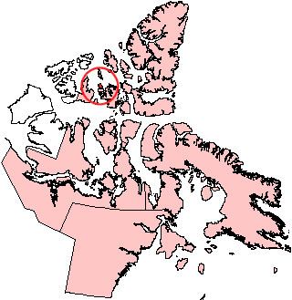
Cameron Island is one of the Canadian arctic islands in Nunavut, Canada. Located in the Arctic Ocean, close to Bathurst Island, it has an area of 1,059 km2 (409 sq mi), 42 to 43 kilometres (26 to 27 mi) long and 47 to 38 kilometres (29 to 24 mi) wide. Île Vanier lies immediately to the south, across the Arnott Strait.
Contents
- Cameron island 2014
- Map of Cameron Island Baffin Unorganized NU Canada
- The newcastle at cameron island jim ballard homes 604 150 promenade drive nanaimo realty
- Commercial oil production
- References
Map of Cameron Island, Baffin, Unorganized, NU, Canada
The newcastle at cameron island jim ballard homes 604 150 promenade drive nanaimo realty
Commercial oil production
Cameron Island is notable as being the only site which has been developed for commercial oil production in the Canadian Arctic islands. From 1985 to 1996 the double-hulled tanker M.V.Arctic shipped the light crude from Bent Horn in the south-west of the island to Montreal. A total of 2.8 million barrels (450,000 m3) was produced until the field was abandoned in 1996. The initial discovery, in 1974 by Panarctic Oils Ltd, reflected the urgency to find new sources of crude oil after the 1973 oil crisis. The abandonment in 1996 reflects the difficulties of exploiting the resource in this harsh environment, although the current production licence (held by Canada Southern Petroleum Ltd) expires in 2010 and could be extended. After abandonment, final clean-up occurred in 1999.
Cameron Island is a desolate spot: a dark-hued landscape of low hills. Oil exploration and traffic on land were concentrated in the winter months, when "winter roads" of compacted snow across the tundra were used by heavy vehicles. Appropriate efforts were taken to minimise the damage to this fragile environment, but where the vegetation was damaged, increased depths of summer thaw occurred. Possibly the greatest concern was caused by the sumps at the well-sites, into which the toxic drilling muds were pumped. These basins, blasted out of the permafrost, relied on the gradual freeze-back of the ground to seal in the waste materials.
Cameron Island was named in 1952 after Maxwell George Cameron (d.1951), the chief cartographer of the surveys and mapping branch, Department of Mines and Technical Surveys.