
Country United States County Clark Area code 360 Elevation 23 m Zip code 98607 | Time zone Pacific (PST) (UTC-8) FIPS code 53-09480 Local time Monday 9:04 PM Population 20,907 (2013) | |
 | ||
Weather 4°C, Wind SW at 13 km/h, 91% Humidity | ||
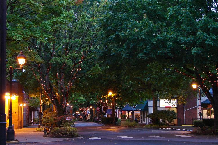
Best towns for families camas washington
Camas /ˈkæməs/ is a city in Clark County, Washington, with a population of 19,355 at the 2010 census. Officially incorporated on June 18, 1906, the city is named after the camas lily, a plant with an onion-like bulb prized by Native Americans. At the west end of downtown Camas is a large Georgia-Pacific paper-mill from which the high school teams get their name "the Papermakers". Accordingly, the city is about 20 miles east (upwind) from Portland, Oregon. Historically, the commercial base of the city was almost solely the paper mill; however, the diversity of industries has been enhanced considerably in recent years by the influx of several white-collar, high-tech companies including Hewlett-Packard, Sharp Microelectronics, Linear Technology, WaferTech and Underwriters Labs. Annual events include the summer "Camas Days", as well as other festivals and celebrations.
Contents
- Best towns for families camas washington
- Map of Camas WA 98607 USA
- Airports
- Bodies of water
- High schools
- Middle schools
- Elementary schools
- Public parks
- Lacamas Park
- Heritage Park
- Geography
- 2010 census
- 2000 census
- Sister cities
- Notable people
- References
Map of Camas, WA 98607, USA
The east side of town borders the city of Washougal, Washington, and the west side of town borders Vancouver, Washington. Camas lies along the Washington side of the Columbia River, across from Troutdale, Oregon, and is part of the Portland, Oregon, Metropolitan Statistical Area as defined by the United States Census Bureau. At this juncture the Columbia River is nearly a mile wide; vehicular traffic flows across the Columbia via the Interstate Bridge on I-5 and the I-205. The main road through town is the limited-access SR 14 expressway.
One of the major geographical features of the city is Prune Hill. Prune Hill is an extinct volcanic vent and is part of the Boring Lava Field of northwest Oregon and southwest Washington.
Based on a test conducted in 2010 Camas ranks 42nd in homeless people per square mile.
Airports
Grove Field Airport
13 miles from Nuke Plant
Bodies of water
High schools
Middle schools
Elementary schools
Public parks
Lacamas Park
Lacamas Park encompasses Round Lake and runs against SR 500 on its west side. Across SR 500 is Lacamas Lake. The park is open year-round from 7 a.m. to dusk and includes barbecues, a play ground, trails around the park and lake, and access to the Camas Potholes.
The park features a network of trails which lead to the Camas Potholes and the Camas lily fields. A 1.2-mile (1.9 km) trail that loops around Round Lake starts and finishes near the parking lot. The park is a popular destination for Geocachers as it contains numerous caches scattered around the park. Young children may play in a small playground on the west side of the park. Tables are provided for picnicking as are waste receptacles designed to receive hot coals from grilling. Bathrooms are available on a seasonal basis only.
Heritage Park
Heritage Park has facilities for launching boats into Lacamas Lake, a playground for young children, lots of open field, and small trails through the trees. The parking lot is very large and includes numerous long parking stalls to accommodate vehicles with trailers.
Geography
According to the United States Census Bureau, the city has a total area of 15.25 square miles (39.50 km2), of which, 13.49 square miles (34.94 km2) is land and 1.76 square miles (4.56 km2) is water.
2010 census
As of the census of 2010, there were 19,355 people, 6,619 households, and 5,241 families residing in the city. The population density was 1,434.8 inhabitants per square mile (554.0/km2). There were 7,072 housing units at an average density of 524.2 per square mile (202.4/km2). The racial makeup of the city was 87.4% White, 1.0% African American, 0.6% Native American, 6.0% Asian, 0.2% Pacific Islander, 1.2% from other races, and 3.6% from two or more races. Hispanic or Latino of any race were 4.1% of the population.
There were 6,619 households of which 46.5% had children under the age of 18 living with them, 65.7% were married couples living together, 8.9% had a female householder with no husband present, 4.6% had a male householder with no wife present, and 20.8% were non-families. 16.2% of all households were made up of individuals and 4.9% had someone living alone who was 65 years of age or older. The average household size was 2.91 and the average family size was 3.27.
The median age in the city was 36.9 years. 31.1% of residents were under the age of 18; 6.5% were between the ages of 18 and 24; 27.1% were from 25 to 44; 26.8% were from 45 to 64; and 8.7% were 65 years of age or older. The gender makeup of the city was 49.6% male and 50.4% female.
2000 census
As of the census of 2000, there were 12,534 people, 4,480 households, and 3,422 families residing in the city. The population density was 1,149.3 people per square mile (443.6/km²). There were 4,736 housing units at an average density of 434.3 per square mile (167.6/km²). The racial makeup of the city was 92.01% White, 0.69% African American, 0.69% Native American, 3.41% Asian, 0.14% Pacific Islander, 0.80% from other races, and 2.26% from two or more races. Hispanic or Latino of any race were 2.86% of the population. 18.8% were of German, 11.3% English, 9.6% American, 8.2% Irish and 5.6% Norwegian ancestry according to 2000 Census.
There were 4,480 households out of which 42.6% had children under the age of 18 living with them, 63.9% were married couples living together, 8.5% had a female householder with no husband present, and 23.6% were non-families. 18.6% of all households were made up of individuals and 6.5% had someone living alone who was 65 years of age or older. The average household size was 2.78 and the average family size was 3.19.
In the city, the age distribution of the population shows 31.2% under the age of 18, 6.2% from 18 to 24, 32.5% from 25 to 44, 21.4% from 45 to 64, and 8.7% who were 65 years of age or older. The median age was 34 years. For every 100 females there were 96.2 males. For every 100 females age 18 and over, there were 94.6 males.
The median income for a household in the city was $60,187, and the median income for a family was $64,885. Males had a median income of $51,470 versus $31,985 for females. The per capita income for the city was $27,267. About 4.4% of families and 5.4% of the population were below the poverty line, including 6.4% of those under age 18 and 4.7% of those age 65 or over.
Sister cities
Camas has the following sister cities, according to [1] and [2]: