
- location below Mount Cedric Basin area 2,241 km² Basin area 2,230 km² Mouth elevation 0 | Length 100 km | |
 | ||
- left Alma Creek, Harper Creek, Alarm Creek, Sandy Creek (Queensland), Larcom Creek, Boundary Creek (Queensland), Gravel Creek - right Maxwelton Creek, Oaky Creek (Queensland), Sheep Station Creek, Double Creek Similar Lake Awoonga, Calliope River Historical, Loders Creek, Port of Gladstone, Thomson River | ||
Calliope river camping ground calliope river near gladstone qld
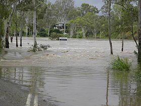
The Calliope River is a river located in Central Queensland, Australia.
Contents
- Calliope river camping ground calliope river near gladstone qld
- Map of Calliope River Queensland Australia
- Calliope river camps australia no 122 qld
- References
Map of Calliope River, Queensland, Australia
The river rises in the Calliope Range inland from the industrial port city of Gladstone, flows past the town of Calliope, before emptying into the Pacific Ocean just north of Gladstone. River length is 98 kilometres (61 mi), with a catchment area of 2,241 square kilometres (865 sq mi).
Oakey, Paddock and Larcom Creeks are the main tributaries of the river. The major industry in the river area is the raising of beef cattle. Like most sub tropical and tropical estuaries, the waters of the river may contain box jellyfish for many kilometres upstream. This venomous, marine animal poses a threat to swimmers.
The Calliope River Historical Village is located beside the Calliope River on the Old Bruce Highway at River Ranch, adjacent to the Bruce Highway.