
Existed: 1964 – present Constructed 1964 | Length 11.22 km | |
 | ||
Restrictions: No hazardous materials in the Posey and Webster Street tubes | ||
State Route 61 (SR 61) is a California, United States, highway which runs along the Oakland International Airport and through Alameda. Two additional "hidden" state highways, State Route 112 (SR 112) and State Route 260 (SR 260), are also signed as part of SR 61, despite having legal descriptions separate from Route 61.
Contents
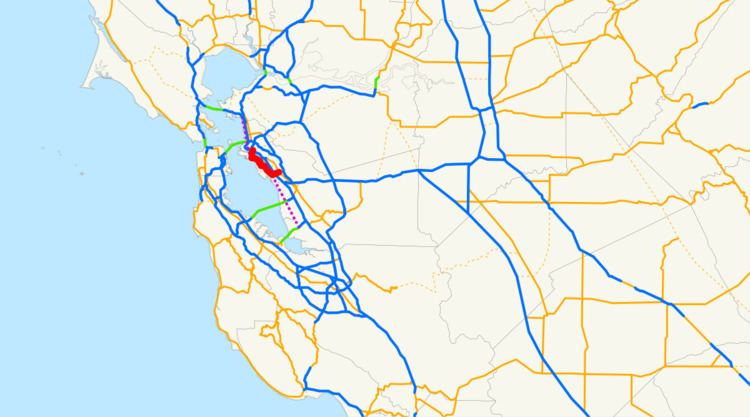
Map of CA-61, California, USA
SR 112 runs along Davis Street from State Route 185 (East 14th Street) west to Doolittle Drive in San Leandro. SR 61 proper then follows Doolittle Drive north near the eastern boundary of Oakland International Airport to Bay Farm Island and across the Bay Farm Island Bridge to Alameda Island. SR 61 then runs on various city streets in Alameda to the intersection of Webster Street and Atlantic Avenue. SR 260 then picks up from there, running northeast along Webster Street and through the Posey and Webster Street tubes to near Interstate 880 in Oakland.
As legislatively defined, Route 61 extends as far north as Albany and as far south as the Dumbarton Bridge's east approach. Only the portion between Routes 260 and 112 is constructed; the unbuilt remainder of the route exists today either as open San Francisco Bay or wetlands. This route would likely have sat atop landfill; as public opinion shifted against filling in the bay, completing the remaining portions of Route 61 also fell out of favor. Route 87 is another highway once proposed to traverse present-day wetlands and open water.
Route description
Route 61 is part of the California Freeway and Expressway System.
The combined SR 112/61/260 route begins at SR 185 in San Leandro. Running along Davis Street, it then interchanges with Interstate 880 before it heads to Doolittle Drive. It then continues northward along Doolittle Drive and enters the city of Oakland, running along the eastern boundary of Oakland International Airport. The route then enters the city of Alameda at Bay Farm Island before crossing the San Leandro Bay via a drawbridge to Alameda Island. SR 61 then goes west along Otis Drive, then north along Broadway until reaching Encinal Avenue. The highway then heads west on Encinal Avenue and Central Avenue to Webster Street. The route then runs across Webster Street and through the Posey and Webster Street tubes before terminating at I-880 and 7th Street in Oakland. The highway does not directly intersect with I-880 here, so drivers are instructed to use the freeway's off-ramps at Broadway, the southbound on-ramp at Oak Street, or the northbound on-ramp at Jackson Street.
California's legislature has relinquished state control of the segment along Webster Street between Central Avenue and Atlantic Avenue, and thus that portion is now maintained by the City of Alameda.
Major intersections
Except where prefixed with a letter, postmiles were measured on the road as it was in 1964, based on the alignment that existed at the time, and do not necessarily reflect current mileage. R reflects a realignment in the route since then, M indicates a second realignment, L refers an overlap due to a correction or change, and T indicates postmiles classified as temporary (for a full list of prefixes, see the list of postmile definitions). Segments that remain unconstructed or have been relinquished to local control may be omitted. The entire route is in Alameda County.