
Length 11.99 km | ||
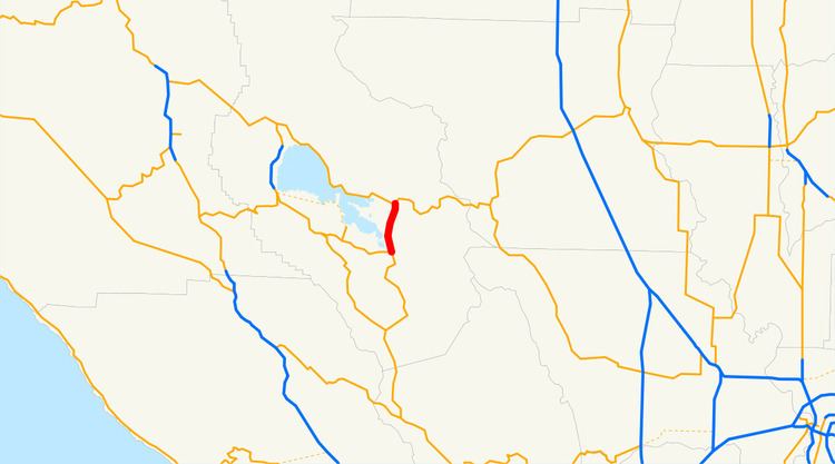 | ||
State Route 53 (SR 53), also known as the Clearlake Expressway, connects SR 29 and SR 20 via the city of Clearlake. It runs in a north–south direction east of Clear Lake.
Contents
Map of CA-53, California, USA
Route description
State Route 53 is part of the California Freeway and Expressway System and is eligible for the State Scenic Highway System. However, it is not a scenic highway as designated by Caltrans.
It begins at California State Route 29 in the town of Lower Lake, near Anderson Marsh State Historic Park, primarily as a four-lane divided semi-rural expressway. The highway then heads northward along Clear Lake, the largest freshwater lake located entirely in California. It bypasses the center of Clearlake, California, instead going through the neighborhood of the "Avenues". Once it crosses Lakeshore Drive, it narrows down to a two-lane highway until its northern terminus at California State Route 20 north of the city limits.
Major intersections
Except where prefixed with a letter, postmiles were measured on the road as it was in 1964, based on the alignment that existed at the time, and do not necessarily reflect current mileage. R reflects a realignment in the route since then, M indicates a second realignment, L refers an overlap due to a correction or change, and T indicates postmiles classified as temporary (for a full list of prefixes, see the list of postmile definitions). Segments that remain unconstructed or have been relinquished to local control may be omitted. The entire route is in Lake County.