
Length 21.51 km | ||
 | ||
State Route 34 (SR 34) is a short state highway in the U.S. state of California.
Contents
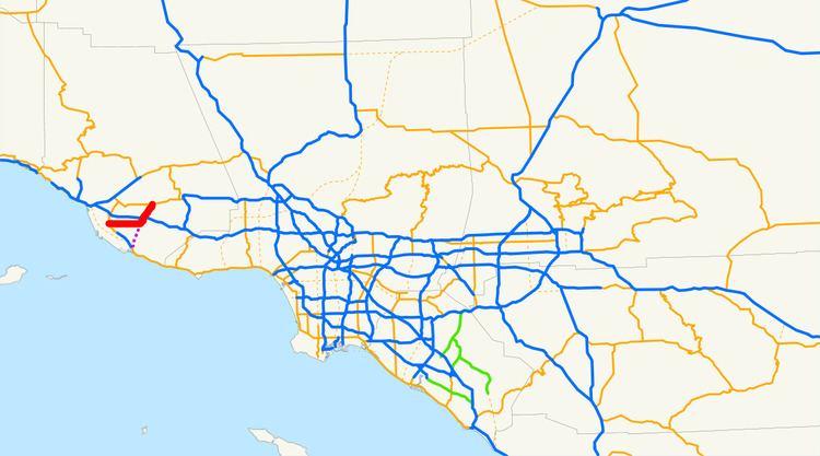
Map of CA-34, California, USA
Route description
SR 34 is part of the California Freeway and Expressway System.
It starts on the west at the intersection of Oxnard Boulevard (Route 1) and Fifth Street in Oxnard. It continues east then northeast on Fifth Street until it intersects Pleasant Valley Road in Camarillo. After continuing east on Pleasant Valley Road a short distance, it turns north onto Lewis Road until the intersection with Las Posas Road at the north city limit of Camarillo where Route 34 continues straight ahead as Somis Road. It ends at Route 118 near Somis. This route originally began in Port Hueneme, but in 1965, the portion from Port Hueneme to Route 1 was deleted. Nevertheless, Route 34 mileposts add on these additional 4 miles (6.4 km) along the signed route.
The route parallels the Southern Pacific Coast Line, which carries Coast Starlight, Pacific Surfliner and Metrolink Ventura County Line passenger trains, for almost its entire current length.
History
In 1933, a road from Huneme to near Somis, going through Oxnard and Camarillo, was added to the state highway system. This road was numbered as Route 153 in 1935. In the 1964 state highway renumbering, SR 34 was defined with this routing, ending at SR 118 on the eastern side. In 1965, the highway from Port Huneme to SR 1 was removed from the state highway system. The part of the highway in Oxnard was authorized by the state legislature to be turned over to the city of Oxnard in 2008.
Future
According to the 2003 Caltrans District 7 Master System Plan Status Map, the segment of California Route 34 on Fifth Street and Pleasant Valley Road will be relocated to a north–south alignment beginning near Calleguas Creek opposite the Naval Air Weapons Station, Point Mugu on California Route 1 and ending near the intersection of Lewis and Pleasant Valley roads.
Major intersections
Except where prefixed with a letter, postmiles were measured on the road as it was in 1964, based on the alignment that existed at the time, and do not necessarily reflect current mileage. R reflects a realignment in the route since then, M indicates a second realignment, L refers an overlap due to a correction or change, and T indicates postmiles classified as temporary (for a full list of prefixes, see the list of postmile definitions). Segments that remain unconstructed or have been relinquished to local control may be omitted. The entire route is in Ventura County.