
Counties: Contra Costa | Length 5.469 km | |
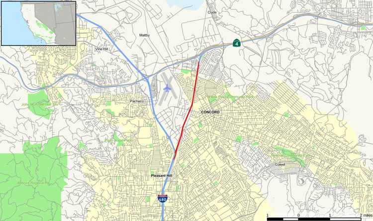 | ||
State Route 242 (SR 242) is a short three-mile (5 km) connector route that links Interstate 680 north of Pleasant Hill to State Route 4 in Concord. In 2000, State Route 242 was widended to six through-traffic lanes for the entire route. Ramp metering is present at all onramps, and is used southbound in the morning and northbound in the evening. It was signed as part of State Route 24 until ca. 1987. Currently, along with Interstate 580, State Route 24, Interstate 680, and State Route 4, it serves as the most direct route between the San Francisco Bay Area and the Sacramento River Delta region of Northern California.
Contents
Map of CA-242, Concord, CA, USA
Route description
SR 242 is part of the California Freeway and Expressway System. The route begins as a freeway at Interstate 680 in Concord. It then heads north, meeting Clayton Road, Concord Avenue, Grant Street, and Olivera Road before meeting its north end at State Route 4 just west of the former Concord Naval Weapons Station.
Exit list
Except where prefixed with a letter, postmiles were measured on the road as it was in 1964, based on the alignment that existed at the time, and do not necessarily reflect current mileage. R reflects a realignment in the route since then, M indicates a second realignment, L refers an overlap due to a correction or change, and T indicates postmiles classified as temporary (for a full list of prefixes, see the list of postmile definitions). Segments that remain unconstructed or have been relinquished to local control may be omitted. The entire route is in Concord, Contra Costa County.