
Length 17.7 km | ||
 | ||
Major cities | ||
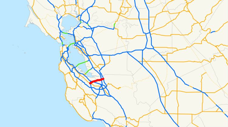
State Route 237 runs from El Camino Real (SR 82) in Mountain View to Interstate 680 in Milpitas. It runs south of the San Francisco Bay, connecting the East Bay to the Peninsula.
Contents
- Map of CA 237 California USA
- Route description
- Highway 237 Bikeway
- Express lanes
- Major intersections
- References
Map of CA-237, California, USA
This route is part of the California Freeway and Expressway System.
Route description
Route 237 begins at a junction of Grant Road with El Camino Real (CA-82) in Mountain View, as a freeway with two lanes in each direction, although most traffic comes from State Route 85. Westbound traffic can connect to Highway 85 southbound, but the eastbound traffic connection to 85 northbound is labeled as an exit for U.S. 101. It intersects with Highway 101 at the southern corner of Moffett Field. After this intersection, a carpool lane is added, for a total of 3 lanes in either direction. It remains like this as until the east end of the freeway at Interstate 880, where most eastbound traffic is directed to northbound 880. The route becomes a street, Calaveras Boulevard, in Milpitas, terminating at Interstate 680.
Before Route 237 was upgraded to freeway status in the mid-1990s, it was a 4-6 lane street, known as Alviso-Milpitas Road or Milpitas-Alviso Road depending on different maps showing the description. Exit signs from U.S. 101 north to Route 237 west currently say "Mountain View-Alviso Road". Starting from half a mile after the highway's western terminus, and ending at the I-880 intersection, Route 237 is constructed to Interstate standards, and is named the Southbay Freeway. It is not part of the Interstate system, however.
The Route 237 corridor has long been sought as a location for a freeway connector between Interstates 680 and 880. Many possible sites have been suggested, from Montague Expressway in North San Jose to Mission Boulevard in Fremont. One map printed before 237's construction to freeway standards between Alviso and 880 showed a new freeway across bay wetlands between Alviso and the Scott Creek Road interchange in South Fremont. Grading and underpasses for a freeway interchange are presently visible along 680 near Scott Creek Road. [1]
Route 237 is known for a number of companies that define Silicon Valley's technological landscape. Many major software and hardware manufacturers have their headquarters along 237. Some of these manufacturers include Lockheed-Martin, Brocade Communications Systems, Nortel Networks, Cisco Systems, Yahoo!, Juniper Networks, TiVo, Ariba and NetApp.
Highway 237 Bikeway
The Highway 237 Bikeway is a 5-mile (8.0 km) pedestrian and bicycle path that parallels State Route 237. The majority of the path is separated from vehicular traffic, however, two sections comprising a total of 1.5 miles (2.4 km) follow an on-street alignment adjacent the freeway.
This bikeway serves as an important connector in the network of trails in San Jose and Santa Clara County. It intersects with the Guadalupe River Trail, which provides access to Downtown San Jose, as well as the San Tomas Aquino Creek and Coyote Creek trails.
Express lanes
The SR 237 Express Lanes, the 4-mile-long (6.4 km) high-occupancy toll (HOT) lanes along Route 237 in both directions between North First Street in San Jose and I-880 in Milpitas, opened on March 20, 2012. Instead of terminating exactly at the I-880 interchange, the Express Lanes continue along the connector ramp to northbound I-880. Solo drivers are required to pay a toll via a FasTrak transponder. Later on, VTA will add express lanes to SR 85, US 101, and also extend the SR 237 Express Lanes to Mathilda Ave.
Major intersections
Except where prefixed with a letter, postmiles were measured on the road as it was in 1964, based on the alignment that existed at the time, and do not necessarily reflect current mileage. R reflects a realignment in the route since then, M indicates a second realignment, L refers an overlap due to a correction or change, and T indicates postmiles classified as temporary (for a full list of prefixes, see the list of postmile definitions). Segments that remain unconstructed or have been relinquished to local control may be omitted. The entire route is in Santa Clara County.