
Length 4.59 km | ||
 | ||
County | ||
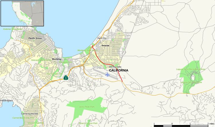
State Route 218 (SR 218) is a state highway in Monterey County in the U.S. state of California. It connects Route 1 with Route 68, taking an approach north of Monterey Regional Airport via the cities of Seaside and Del Rey Oaks.
Contents
Map of CA-218, California, USA
Route description
The route begins at State Route 1 in Seaside. It then exits the city and enters Del Rey Oaks, where it shortly meets its east end at California State Route 68.
Major intersections
Except where prefixed with a letter, postmiles were measured on the road as it was in 1964, based on the alignment that existed at the time, and do not necessarily reflect current mileage. R reflects a realignment in the route since then, M indicates a second realignment, L refers an overlap due to a correction or change, and T indicates postmiles classified as temporary (for a full list of prefixes, see the list of postmile definitions). Segments that remain unconstructed or have been relinquished to local control may be omitted. The entire route is in Monterey County.