
Length 33.8 km | ||
 | ||
County | ||
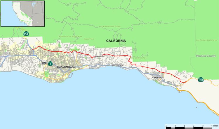
State Route 192 (SR 192) is a state highway in the U.S. state of California. The route runs from Santa Barbara to State Route 150 near the Ventura/Santa Barbara county line. It is a two-lane road.
Contents
Map of CA-192, California, USA
Route description
The western terminus is at State Route 154 in Santa Barbara at the intersection of San Marcos Pass Road, Cathedral Oaks Road, and Foothill Road. It runs east on Foothill Road, Mountain Drive, Stanwood Drive, Sycamore Canyon Road, East Valley Road, Toro Canyon Road, Foothill Road, then Casitas Pass Road. The eastern terminus is at State Route 150 near the Ventura/Santa Barbara County line at the intersection of Casitas Pass Road and Rincon Road.
History
This route was originally part of State Route 150, which was signed in 1934. It was renumbered to Route 192 in 1964.
Major intersections
Except where prefixed with a letter, postmiles were measured on the road as it was in 1964, based on the alignment that existed at the time, and do not necessarily reflect current mileage. R reflects a realignment in the route since then, M indicates a second realignment, L refers an overlap due to a correction or change, and T indicates postmiles classified as temporary (for a full list of prefixes, see the list of postmile definitions). Segments that remain unconstructed or have been relinquished to local control may be omitted. The entire route is in Santa Barbara County.