
Existed: 1919 – present Constructed 1919 | West end: Wauteck Village Length 38.41 km | |
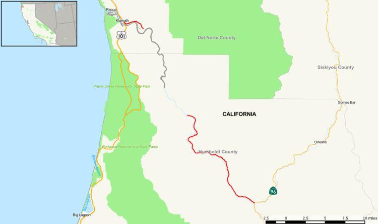 | ||
State Route 169 (SR 169) is a state highway in northern California.
Contents
Map of CA-169, California, USA
Route description
The route begins at U.S. Route 101 near Klamath and after a discontinuity from Klamath Glen (near the McBeth Airport) to Johnsons via the Yurok Indian Reservation, resumes at the town of Wautec. The highway continues through Pecwan before the curving road heads southeast and passes through Martins Ferry after several miles. SR 169 ends at State Route 96 near Weitchpec. The entire route is within the Yurok Indian Reservation.
Major intersections
Except where prefixed with a letter, postmiles were measured on the road as it was in 1964, based on the alignment that existed at the time, and do not necessarily reflect current mileage. R reflects a realignment in the route since then, M indicates a second realignment, L refers an overlap due to a correction or change, and T indicates postmiles classified as temporary (for a full list of prefixes, see the list of postmile definitions). Segments that remain unconstructed or have been relinquished to local control may be omitted. The numbers reset at county lines; the start and end postmiles in each county are given in the county column.