
Existed: 1972 – present Length 17.84 km | Constructed 1972 | |
 | ||
South end: A Street and Ash Street in Downtown San Diego | ||
California state route 163 through balboa park
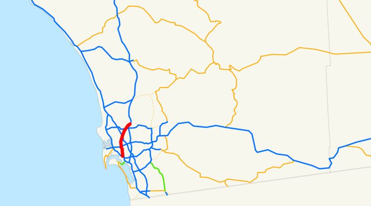
State Route 163 (SR 163), the Cabrillo Freeway, is a state highway in San Diego, California. It is an 11.088-mile (17.844 km) stretch of freeway which was once the southern end of U.S. Route 395 (US 395), the San Diego portion of which was eliminated in 1972. It begins in Downtown San Diego just west of an interchange with Interstate 5 (I-5), extending north to its terminus at I-15 at the south end of Miramar.
Contents
- California state route 163 through balboa park
- Map of CA 163 San Diego CA USA
- Route description
- History
- Exit list
- References
Map of CA-163, San Diego, CA, USA
Route description
The southernmost 2.5 miles (4.0 km) of SR 163 passes through Balboa Park and under the Cabrillo Bridge. Emerging from Downtown San Diego on an intersection with Ash Street, it crosses I-5 before entering Balboa Park. The section of SR 163 south of I-8 through Balboa Park is not Interstate standard, featuring a wide, grassy median with many mature trees. It has only four lanes for the most part and has several sharp curves (for a freeway). In an effort to improve safety along this section, wooden guardrails with steel reinforcement were installed in December 2004 on either side of the grassy median. The section of SR 163 north of I-8 is an Interstate-standard, eight-lane freeway. Just north of the interchange with I-8, the expressway treks north, climbing uphill from Mission Valley to Linda Vista, where it has an interchange with Genesee Avenue. After a northbound only exit with Mesa College Drive / Kearny Villa Road, the interchange with I-805 is northbound only in the northbound direction and southbound only in the southbound direction. In Kearny Mesa, the freeway has interchanges with Balboa Avenue, and Clairemont Mesa Boulevard, in which between the two interchanges, it gains a frontage road on both sides of the freeway. Following the Clairemont Mesa Blvd. interchange, it heads north to SR 52, where it forms one part of one of the biggest bottlenecks in San Diego County. The freeway then heads north to Kearny Villa Road, which was a former route of I-15, before terminating at the current I-15 near Miramar and the southern terminus of the reversible lanes of I-15. Ramps were built to allow traffic on SR 163 to enter and exit the express lanes of I-15.
This route is part of the California Freeway and Expressway System and is designated a State Scenic Highway.
History
The southernmost portion of the highway, running through Balboa Park, began construction in 1942 and opened in 1948 as part of US 395; it was the first freeway in San Diego County and one of the first in California. The Cabrillo Freeway was also part of US 80 from the late 1940s until 1964. This stretch of road has been called one of America's most beautiful parkways, and was designated a California Historic Parkway in 2002.
There were previously southbound entrances at Quince and Richmond Streets, but these have been closed. The single-lane bridge at Richmond Street which allowed this entrance still exists but is closed to traffic, and the remainder of the ramp has been demolished.
In the mid 90s, Shawn Nelson, a US Army soldier and plumber, stole a tank from the National Guard and took it outside the base and onto the highway. He was shot by police, when the tank got stuck in the median and he did not survive.
Exit list
The entire route is in San Diego, San Diego County.