
Length 19.31 km | ||
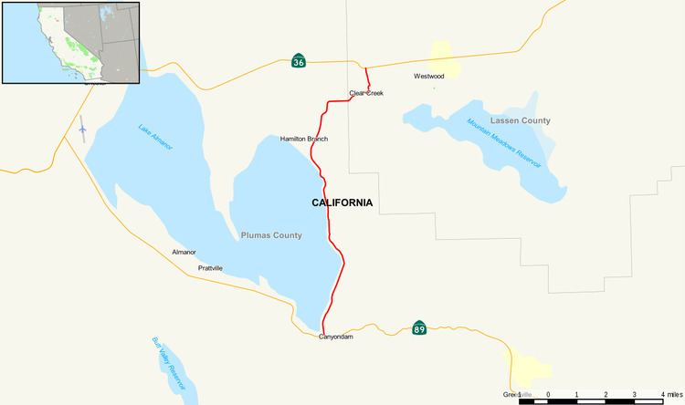 | ||
State Route 147 (SR 147) is a state highway in the U.S. state of California. The route runs along the eastern side of Lake Almanor. It serves as a bypass to connect State Route 89 and State Route 36 on the eastern side of the lake, whereas the two highways already meet on the western side in Chester.
Contents
Map of CA-147, Westwood, CA 96137, USA
Route description
The route begins at State Route 89 in Canyondam. As it continues through Plumas County, it intersects County Route A13 before exiting the county. It then enters Lassen County where it intersects County Route A21 before meeting its north end at State Route 36.
Major intersections
Except where prefixed with a letter, postmiles were measured on the road as it was in 1964, based on the alignment that existed at the time, and do not necessarily reflect current mileage. R reflects a realignment in the route since then, M indicates a second realignment, L refers an overlap due to a correction or change, and T indicates postmiles classified as temporary (for a full list of prefixes, see the list of postmile definitions). Segments that remain unconstructed or have been relinquished to local control may be omitted. The numbers reset at county lines; the start and end postmiles in each county are given in the county column.