
Location County Kerry, Ireland Elevation 338 m | Parent range Sheep's Head peninsula Prominence 143 m | |
 | ||
Similar Knockanore Mountain, Brassel Mountain, Broaghnabinnia, The Bones, Caher West Top | ||
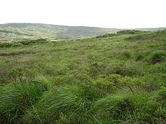
Caher Mountain (Irish: Cathair = "stone ring-fort") is a hill, 338 metres high, with spectacular views on the Sheep's Head peninsula, roughly west of and above the village of Kilcrohane in County Cork, Ireland.
Contents
Map of Caher Mountain, Caher-Mountain, Co. Cork, Ireland
Location
Caher Mountain is located some 15 km from the end of the Sheep's Head peninsula and around 4 km west of Kilcrohane. Its neighbouring summit is Seefin (345 m), some 5 km to the northeast. It is at grid reference V793380 and is easily reached on an easy walk from a lay by about 1.5 km above the village.
Views
In clear weather there are views as far as Dursey Island and the Iveragh Peninsula from Caher Mountain.
References
Caher Mountain Wikipedia(Text) CC BY-SA