
Time zone UTC + 7 (UTC+7) Area 486.4 km² Local time Wednesday 7:25 AM | Elevation 70 m Population 203,435 (2015) | |
 | ||
Weather 15°C, Wind NE at 16 km/h, 91% Humidity | ||
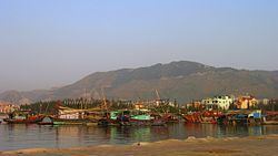
Cẩm Phả ( listen) is a city of Quảng Ninh Province in the north-east region of Vietnam. As of February 2012, the city had a population of 195,800. The city covers an area of 486 km². The city was promoted from Cam Pha District by February, 2012. Cẩm Phả was the site of one of the biggest coal mines in south of Asia which has been exploited for almost a century. The coal mine featured on a special commemorative Vietnam stamp in March 1959. Coal still forms the basis of Cẩm Phả's local economy, with other industries including quarrying, lime production, port, agriculture, forestry and fisheries.
Contents
- Map of Tp CE1BAA9m PhE1BAA3 QuE1BAA3ng Ninh Province Vietnam
- Administrative divisions
- Environment
- References
Map of Tp. C%E1%BA%A9m Ph%E1%BA%A3, Qu%E1%BA%A3ng Ninh Province, Vietnam
The official town website claims several scenic and historical sites in Cẩm Phả including the Cửa Ông Temple, Rều Island (Monkey Island), Thẻ Vàng Island, the Vũng Đục historical site, and Hang Hanh cave.
Administrative divisions
The city contains 13 phường: Quang Hanh, Cẩm Thạch, Cẩm Thuỷ, Cẩm Trung, Cẩm Thành, Cẩm Tây, Cẩm Bình, Cẩm Đông, Cẩm Sơn, Cẩm Phú, Cẩm Thịnh, Cửa Ông, Mông Dương, and 3 communes: Dương Huy, Cộng Hoà, Cẩm Hải.
Environment
Coal mining in Cẩm Phả started over 100 years ago. Mining area discharges to the sea about 9 millions m3 waste water and 8 million m3 domestic waste water. Another issue is deforestation, for example, from 1969 to 1974, about 42% of area of forest land was reduced.