
Status Municipality Climate Dfb Population 30,025 (2011) | County Argeş County Time zone EET (UTC+2) Area 11.7 km² Local time Tuesday 11:15 PM | |
 | ||
Weather 6°C, Wind E at 11 km/h, 87% Humidity Points of interest Mănăstirea Negru Vodă, Jidava, Muzeul de Istorie, Muzeul de Etnografie și Artă P, Vila Golescu | ||
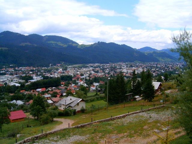
Câmpulung (also spelled Cîmpulung, [kɨmpuˈluŋɡ], German: Langenau), or Câmpulung Muscel, is a city in the Argeş County, Muntenia, Romania. It is situated among the outlying hills of the Carpathian mountains, at the head of a long well-wooded glen traversed by the Râul Târgului, a tributary of the Argeş.
Contents
Map of C%C3%A2mpulung, Romania
Its pure air and fine scenery render Câmpulung a popular summer resort. In the city there are more than twenty churches, besides a monastery and a cathedral, which both claim to have been founded in the 13th century by Radu Negru, legendary first Prince of Wallachia.
Name
"Câmpulung" literally means "Long Field" in Romanian.
History
Near Câmpulung are the remains of a Roman camp now known as the Castra of Jidava (or Jidova); and just beyond the gates, vestiges of a Roman colony, variously identified with Romula, Stepenium and Ulpia Traiana, but now called Grădiştea (meaning place of a fortress in Romanian) or Jidovi.
Câmpulung was one of the earliest urban settlements in Wallachia, the Transylvanian Saxon colonists contributing to its development by bringing the German urban culture. The earliest written evidence of the town's existence is dated 1300, and is to be found in the Câmpulung church. The inscription is an epitaph of Laurencius de Longo Campo, the full text being Hic sepultus est comes Laurencius de Longo-Campo, pie memorie, Anno Domini MCCC ("Here is buried Laurentius of Longus-Campus, in pious memory, Anno Domini 1300"). Laurentius was most likely the person coordinating the colonization process.
The elongated shape of the town was determined by the valley and it had two main parallel streets. The town had a central market square, located near Prince's Church of Saint Nicholas and an annual fair which was held in the west of the town, near St. Elijah's Church. The non-German areas of the town were found towards the outskirts of the medieval town, where two Orthodox churches were built during the 14th-15th centuries.
Originally, the Romanians of the town did not have the same rights as the German colonists, but by the 15th century, the two communities were already merged, as shown by the new Romanian churches built near the Catholic areas and that some of the județs were elected were Romanians. Another community in the town were the Bogomil Bulgarians, who settled in the Șchei neighbourhood (Șchei being an old Romanian word referring to Slavic people). Outside the town, in the south-west, on the hill currently named Câmpul mișeilor ("Field of the cripple") was a leper colony, which had its own church and mill.
Câmpulung was the first capital of the feudal state of Wallachia, until succeeded by Curtea de Argeş in the 14th century. There was a considerable traffic with Transylvania, over the Bran Pass, 15 miles to the north, and with the south by a branch railway to Ploieşti.