
 | ||
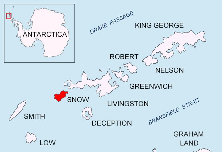
Byewater Point is the rocky point forming the northwest extremity of Snow Island in the South Shetland Islands, Antarctica. It is a north entrance point for Boyd Strait. The area was visited by 19th century sealers.
Contents
The feature was charted and named in 1829 by the British naval expedition under Captain Henry Foster.
Location
The cape is located at 62°45′10″S 61°30′07.4″W which is 10.3 km southwest of Cape Timblón, 10.58 km north-northwest of Cape Conway and 42.8 km east-northeast of Cape Smith, Smith Island (British mapping in 1968, Argentine in 1991, Bulgarian in 2009).
Map
References
Byewater Point Wikipedia(Text) CC BY-SA