
Population 810 (2011 census) Postal code 2136 | Postcode(s) 2136 Area 30 ha | |
 | ||
Location 12 km (7 mi) from Sydney CBD | ||
Burwood Heights is a suburb in the Inner West of Sydney, in the state of New South Wales, Australia. It is located 12 kilometres west of the Sydney central business district and is situated within the local government area of Burwood Council.
Contents
Map of Burwood Heights NSW 2136, Australia
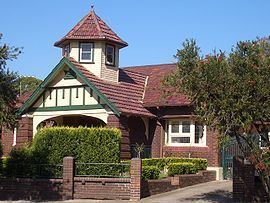
Burwood Heights is a residential suburb with no shops, schools or any public buildings. The postcode is 2136, the same as neighbouring Enfield. Burwood is a separate suburb, to the north.
History
The Geographical Names Board of New South Wales assigned Burwood Heights the status of a separate suburb on 19 January 2007.
Population
According to the 2011 census of Population, there were 810 residents in Burwood Heights. In Burwood Heights, 57.8% of people were born in Australia. The most common countries of birth were Italy 9.3%, China (excludes SARs and Taiwan) 5.3%, Greece 2.7%, Vietnam 2.2% and England 2.0%. 48.3% of people only spoke English at home. Other languages spoken at home included Italian 13.9%, Greek 7.4%, Arabic 5.6%, Mandarin 4.7% and Korean 2.2%. The most common responses for religion in Burwood Heights (State Suburbs) were Catholic 39.2%, No Religion 13.9% and Eastern Orthodox 9.8%.