
Length 17.6 mi (28.3 km) To SW Barnes Road Completed 1892 | Completion 1892 | |
 | ||
Former name(s) B Street (east of SW 16th)Washington Street (west of SW 16th) | ||
Happy pharrell williams burnside street acoustic cover
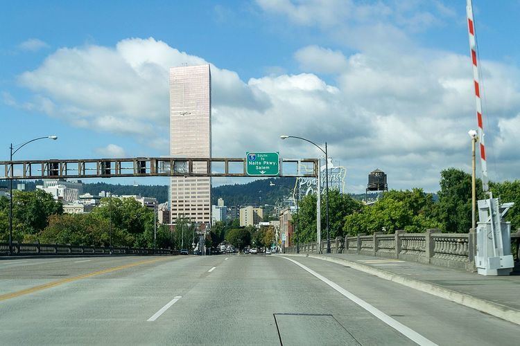
Burnside Street is a major thoroughfare of Portland, in the U.S. state of Oregon, and one of a few east–west streets that runs uninterrupted on both sides of the Willamette River. It serves as the dividing line between North Portland and South Portland. Its namesake bridge, Burnside Bridge, is one of the most heavily traversed in Portland.
Contents
- Happy pharrell williams burnside street acoustic cover
- Map of Burnside Scrabster Thurso KW14 7UG UK
- Feeling good burnside street acoustic cover
- History
- References
Map of Burnside, Scrabster, Thurso KW14 7UG, UK
Feeling good burnside street acoustic cover
History
What is now Burnside Street was originally named B Street east of Southwest 16th Avenue and Washington Street west of S.W. 16th (as a continuation of Washington Street from downtown). In 1891, B Street was renamed for Portland merchant David Burnside, and in 1933 Washington Street west of SW 16th was renamed Burnside Street. Burnside became Portland's principal east–west axis following the 1912 Bennett Plan, soon becoming one of the widest streets in the city. The street runs from SW Barnes Road in Sylvan-Highlands to the Mount Hood Highway in Gresham, a distance of over 17 miles (27 km). It crosses the Willamette River via the Burnside Bridge, where the White Stag sign is visible.
For a number of years, the portion of Burnside between NW 19th Avenue and NE Sandy Boulevard was designated U.S. Route 30. It is served by TriMet bus line 20 between Barnes Road and NE/SE 102nd Avenue, and several MAX Blue Line light-rail stations are located along its route in East Portland between 102nd Avenue and Ruby Junction.