
Primary outflows Whillan Beck Max. depth 13 m (43 ft) Area 24 ha Catchment area 6.02 km² | Surface area 23.9 ha (59 acres) Surface elevation 253 m Catchment area 6.02 km² Outflow location Whillan Beck | |
 | ||
Around burnmoor tarn by mountain bike
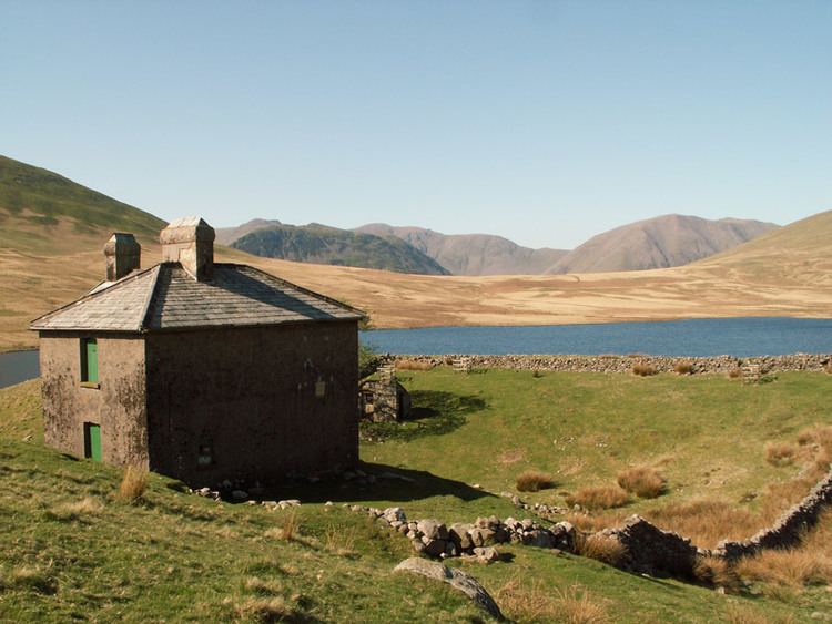
Burnmoor Tarn, on Eskdale Fell in Cumbria, England, is one of the largest entirely natural tarns in the Lake District. Its waters flow into Whillan Beck at the tarn's north-eastern corner, which immediately turns south and flows into Eskdale, joining the Esk at Beckfoot. Burnmoor Lodge, a former fishing lodge, stands by the southern shore and a mediaeval corpse road runs past the eastern shore where it fords the beck.
Contents
- Around burnmoor tarn by mountain bike
- Map of Burnmoor Tarn Seascale UK
- Burnmoor tarn solo wild camp
- References
Map of Burnmoor Tarn, Seascale, UK
The tarn is one of the sites in DEFRA's UK Upland Waters Monitoring Network. It occupies 23.9 ha and lies at an altitude of 253 m in a moraine hollow on the uplands between Wastwater and Eskdale. The lake has two distinct basins close to the south-eastern shore and a maximum depth of 13 m. There are four main inflow streams to the north and north-west. The outflow at the eastern end joins the Hardrigg Beck which drains the slopes of Scafell and, in times of especially high flow, is partly diverted into the lake across a braided delta.