
Easiest route walking track Prominence 120 m | Elevation 653 m | |
 | ||
Topo map Murrurundi 9034 (1:100000)Murrurundi 90324N (1:25000) Similar Mount Sugarloaf, Mount Cabrebald, Polblue, Careys Peak, Mount Royal | ||
Official burning mountain festival 2016 aftermovie
Burning Mountain, the common name for Mount Wingen, is a hill near Wingen, New South Wales, Australia, approximately 224 km (139 mi) north of Sydney just off the New England Highway. It takes its name from a smouldering coal seam running underground through the sandstone. Burning Mountain is contained within the Burning Mountain Nature Reserve, which is administered by the NSW National Parks and Wildlife Service (NPWS).
Contents
- Official burning mountain festival 2016 aftermovie
- Map of Burning Mountain Wingen NSW 2337 Australia
- Coal seam fire
- References
Map of Burning Mountain, Wingen NSW 2337, Australia
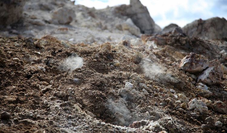
A trail with information panels runs from the parking lots to the site where smoke emanates from the ground.
Coal seam fire
The underground fire is estimated to be at a depth of around 30 m (100 ft). It is estimated that the fire has burned for approximately 6,000 years and is the oldest known coal fire.
European explorers and settlers to the area believed the smoke, coming from the ground, was volcanic in origin. It was not until 1829 that geologist Reverend C.P.N. Wilton identified it as a coal seam fire.
The fire is generally moving in a southerly direction at a rate of about 1 m (3 ft) per year. The combustion has caused soil discolouration and an uneven ground surface in the area.