
OS grid NY785375 Elevation 747 m | Topo map OS Landranger 91 Prominence 190 m | |
 | ||
Listing Hewitt, Marilyn, Nuttall Similar Mickle Fell, Tosson Hill, Cold Fell, Long Crag, Shillhope Law | ||
Burnhope seat
Burnhope Seat is a moor in the North Pennines of England. It lies between the heads of the Rivers Tees and Wear. The summit is crossed by the boundary between County Durham and Cumbria (historically Cumberland). It is the highest point in historic County Durham.
Contents
Map of Burnhope Seat, Alston, UK
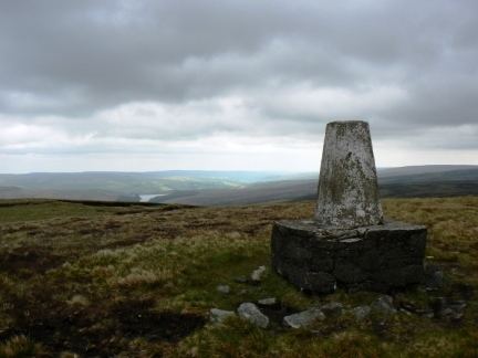
The B6277 road between Alston and Middleton-in-Teesdale passes within 2 km of the summit, thus providing the easiest route of ascent. The hill may also be climbed from Weardale as part of high-level circuit of Burnhope Reservoir. The highest point of the hill lies in Cumbria, some 200 m west of a trig point on the border.
There are some ski-tows on the northwest slopes of the hill - this forms the Yad Moss ski facility, which has recently been upgraded by Sport England.
The entire area is designated "access land" under the terms of the Countryside and Rights of Way Act 2000.