
Prominence c. 20 m Elevation 475 m | OS grid NY110209 | |
 | ||
Topo map OS Landranger 89, 90, Explorer OL4 Similar | ||
Burnbank Fell is a small hill in the west of the English Lake District. It is the most westerly of the Loweswater Fells, a group of low grassy hills lying just south of Loweswater. The hill is predominantly grassy with sprawling flanks and a broad ridge connecting it to Blake Fell. It can be climbed from Lamplugh in the west, or from Waterend on the lakeshore.
Contents
Map of Burnbank Fell, Cockermouth, UK
Topography
The Western Fells occupy a triangular sector of the Lake District, bordered by the River Cocker to the north east and Wasdale to the south east. Westwards the hills diminish toward the coastal plain of Cumberland. At the central hub of the high country are Great Gable and its satellites, while two principal ridges fan out on either flank of Ennerdale, the western fells in effect being a great horseshoe around this long wild valley. Burnbank Fell and the other Loweswater Fells form the extremity of the northern arm.
The Loweswater Fells have been compared to the digits of a hand, radiating out south westward from the "palm" centred on Loweswater village. From the west these are Burnbank Fell, Blake Fell, Gavel Fell, Hen Comb and Mellbreak, the "thumb".
Burnbank Fell marks the north western perimeter of the Lakeland Fells, its feet set on the boundary of the National Park. Beyond lie the valley of the River Marrom and the industrial towns of the coastal plain. Beyond the park boundary is the low double top of Mockerkin How (810 ft), standing above Mockerkin Tarn. This is a natural waterbody, known for its water lilies and stocked with eel, pike and perch. It is associated with several local legends, including that of a sunken town.
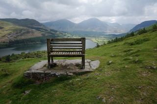
The north eastern flanks of Burnbank Fell are much steeper, with some crags on the upper slopes overlooking Loweswater. Lower down the fellside is Holme Wood, an attractive background to views across the lake. Holme Beck runs down through the trees, forming the boundary between Burnbank Fell and Blake Fell to the south. High up in the woods is Holme Force, an attractive parallel pair of waterfalls.
A west ridge drops from the summit across an easy grassy saddle to Owsen Fell (1,342 ft). This is generally considered a part of Burnbank Fell although some guidebooks differ. Owsen Fell descends to the village of Lamplugh, conifer plantations being operated on the lower slopes. All drainage from Owsen Fell and the western slopes drains to the River Marron and ultimately the Derwent.
Geology
The summit area is composed of the laminated mudstone and siltstone of the Kirk Stile Formation. The eastern slopes show outcropping of the Loweswater Formation of greywacke sandstone turbidities.
The Ordnance Survey Explorer map series show abandoned mine levels above Wisenholme Beck and some surface extraction near the summit. Wainwright shows a further old level on the eastern slopes.
Summit
The top of Burnbank Fell is a rounded grassy dome, the summit marked by an old fence post and small cairn. The Lakeland view is greatly restricted by Blake Fell although there is a vista of the Northern and North Western Fells. Loweswater is hidden by the slope although Crummock Water comes into view a few paces to the north east. The view of the coast, Isle of Man, Solway Firth and Criffel is uninterrupted.
Ascents
From Lamplugh the obvious line is up Owsen Fell, although there is doubt over right of access. From Waterend at the head of Loweswater, the route starts via Hudson Place farm and passes into Holme Wood. Various paths can then be taken to the summit. Two paths contour the fell on this side, one on the lakeshore and another "terrace" above the woods. Both provide pleasant walking in their own right. Fangs Brow farm can be used as an access point to the terrace path from the north.