
 | ||
Points of interest Wast Water, Church of St Olaf - W, Kirk Fell, Middle Fell, Buckbarrow | ||
Wasdale weekend storm desmond time
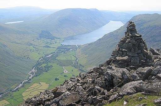
Wasdale (/ˈwɒzdeɪl/ WOZ-dayl) is a valley and civil parish in the western part of the Lake District National Park in Cumbria, England. The River Irt flows through the valley to its estuary at Ravenglass. A large part of the main valley floor is occupied by Wastwater, the deepest lake in England (258 feet). The population of Wasdale was only minimal and, from the 2011 Census is included in the parish of Gosforth.
Contents
- Wasdale weekend storm desmond time
- Map of Wasdale UK
- Wasdale wastwater sep 08
- Geographical features
- Settlements
- Fells
- Etymology
- References
Map of Wasdale, UK
Wasdale wastwater sep 08
Geographical features
On the south-eastern side of the lake are very steep screes below the summits of Whin Rigg and Illgill Head which are more accessible on the far side. The head of the valley is dominated by the Great Gable and Scafell Pike, the highest peak in England, which, along with Scafell, Kirk Fell and Yewbarrow, surround the small community of Wasdale Head. Wasdale is famous amongst rock climbers as the home of British rock climbing. A classic route is Nape's Needle on Great Gable.
Settlements
At the hamlet of Wasdale Head is St Olaf's Church, one of the smallest churches in England.
Further down the valley are the villages of Strands and Gosforth.
Fells
Clockwise from the north-west:-
Sty Head Pass
Etymology
The name came from Old Norse Vatnsdalr = "valley of the water". The alternative spelling "Wastdale" existed through much of the 19th century.