
First contested 2004 District webpage profile, map Elector 80,110 | District created 2003 Last contested 2011 Population (2011) 131,917 District abolished 2013 | |
 | ||
Census divisions Metro Vancouver Regional District, Burnaby, New Westminster | ||
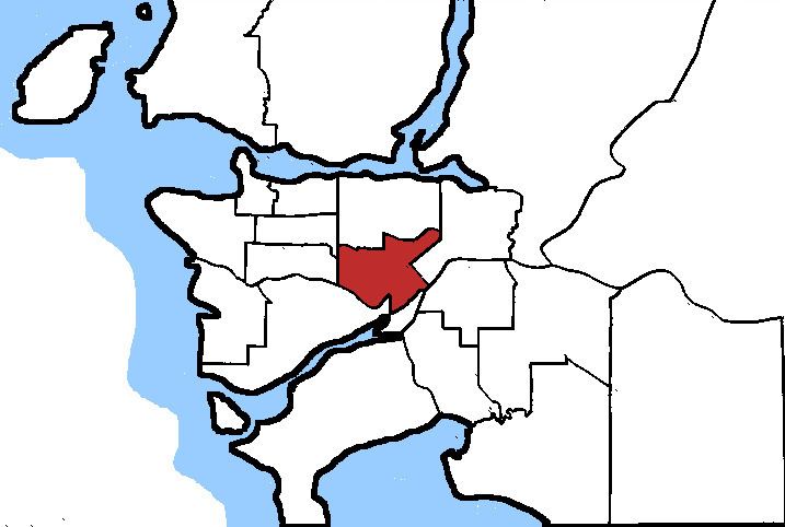
Burnaby—New Westminster was a federal electoral district in British Columbia, Canada, that was represented in the House of Commons of Canada from 2004 to 2015.
Contents
Demographics
(According to the Canada 2001 Census)
Ethnic groups: 50.7% White, 20.2% Chinese, 10.6% South Asian, 4.3% Filipino, 2.9% Korean, 2.0% Aboriginal, 1.7% Latin American, 1.7% Black, 1.4% Japanese, 1.2% Southeast Asian
Languages: 48.7% English, 1.0% French, 48.0% Other, 2.2% Multiple languages
Religions: 21.1% Protestant, 19.1% Catholic, 6.1% Sikh, 4.6% Muslim, 4.4% Buddhist, 2.9% Christian Orthodox, 1.7% Hindu, 5.7% Other Christian, 33.5% No religious affiliation
Average income: $27,356
Geography
The riding includes all of the City of New Westminster west of 8th Street and all of the city of Burnaby south of the following line: Kingsway to Sussex Avenue to Grange Street to Dover Street to Oakland Street to Sperling Avenue to the Trans-Canada Highway.
History
The riding was created in 2003 from parts of New Westminster—Coquitlam—Burnaby, Vancouver South—Burnaby, and Burnaby—Douglas.
According to the electoral boundaries set out by the 2012 Federal Electoral Boundaries Commission for British Columbia, the riding was dissolved, with various parts joining the new ridings of Burnaby South, New Westminster—Burnaby and Richmond Centre.