
Intercommunality Londinières Area 10.99 km² | Region Normandy Canton Londinières Population (2006) 313 Local time Tuesday 2:28 AM | |
 | ||
Weather 7°C, Wind W at 18 km/h, 89% Humidity | ||
Bures-en-Bray is a commune in the Seine-Maritime department in the Haute-Normandie region in northern France.
Contents
Map of 76660 Bures-en-Bray, France
Geography
A farming village situated in the Pays de Bray, 20 miles (32 km) southeast of Dieppe, at the junction of the D1 with the D114 and D12 roads. The Béthune River flows through the middle of the village.
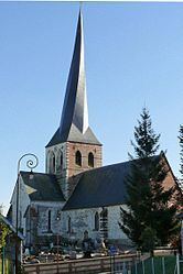
Places of interest
References
Bures-en-Bray Wikipedia(Text) CC BY-SA