
 | ||
The Bundjalung people are a large Aboriginal nation, a federation of a number of groups of clans which occupy the land from Grafton on the Clarence river of northern New South Wales north to the town of Ipswich and the Beaudesert, in southern Queensland, and down around the other side of the Great Dividing Range and back to Grafton. In the north, Bundjalung Nation shares a border with Yuggera Nation and Barrunggam Nation; to the east the Tasman Sea (Pacific Ocean); to the south Gumbaynggirr (also known as Kumbainggar) Nation; and to the west it borders Ngarabal Nation.
Contents
In pre-colonial times, Bundjalung Nation encompassed some of the richest hunting and fishing grounds anywhere on the Australian continent. According to the oral traditions of the Bundjalung People, these areas were first settled by the Three Brothers and their descendants.
The names of the 15 tribal groups comprising the Bundjalung Nation are Arakwal, Banbai, Birbai, Galiabal, Gidabal, Gumbainggeri, Jigara, Jugambal, Jugumbir, Jungai, Minjungbal, Ngacu, Ngamba, Nyangbal and Widjabal.
The 2007 Githabul Federal Court Native Title Determination which was lodged by Trevor Close a commercial lawyer now living in Perth cut the Bundjalung Nation apart can be viewed here.
To the best of knowledge the Bundjalung Nation Aboriginal people from the East Coast of Australia, the Far North Coast of New South Wales and South East Queensland area, are the only ones whose dream time stories talk about arriving in Australia from elsewhere. They came from the land "at the centre of the world" when a massive catastrophe destroyed it.
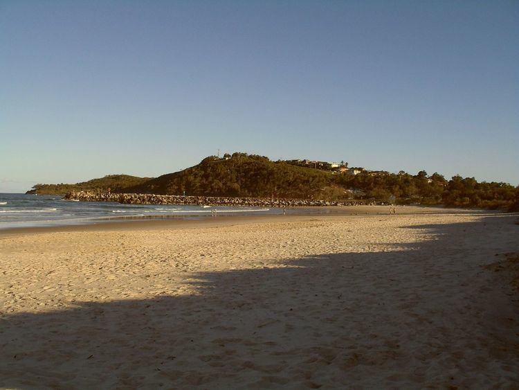
Bundjalung Nation Aboriginal people have lived on and visited Goanna Headland for at least 12,000 years. The Aboriginal tribes were not united anytime before the 18th century, with more than 20 main groups, known collectively as the 'Bundjalung Nation'. Certain deities and religious practices were specific to certain localities.
Goanna Headland is also significant as the site where the ancestors of the Bundjalung people arrived by sea and populated the surrounding country. This event is related through the legend of "The Three Brothers (Bundjalung Nation) ".
European discovery
On 15 May 1770, the coast in the vicinity of Evans Head was first mapped and described by Lieutenant James Cook (also known as Captain Cook FRS RN) on the HMS Endeavour (also known as His Majesty's Bark the Endeavour or HMS Bark Endeavour, a Royal Navy of the United Kingdom research vessel commanded by Lieutenant James Cook on his first voyage of discovery, to Australia and New Zealand from 1769 to 1771). Cook spent only one day in the area and did not land on the mainland but the next day on 16 May, Cook named Cape Byron and Mount Warning (or Wollumbin), after seeing the mountain from the sea while sailing past.
Lieutenant James Cook failed to notice the entrance to the Richmond River on 15 May 1770, but noted the presence of about 20 Bundjalung Nation Aboriginal people on what is now Seven Mile Beach, just to the south of Broken Head. Sir Joseph Banks also noted these people and remarked that they completely ignored the presence of the HMS Endeavour. This would seem to indicate that the HMS Endeavour was not the first ship that they had seen (Richmond River Historical Society {RRHS}, 1997).
On 20 August 1828 Captain Henry John Rous on the frigate HMS Rainbow dropped anchor at Byron Bay. His mission was to discover a navigable river and safe anchorage site. On 26 August 1828 Captain Henry John Rous on the frigate HMS Rainbow discovers the entrance to the Richmond River (the longest navigable river on the coast of NSW) and explores 32 kilometers up the river with two lieutenants in a Pinnace, as far as Tuckean Swamp. Captain Henry John Rous subsequently named the river Richmond after his brother's best friend, Charles Gordon-Lennox, 5th Duke of Richmond.
European invasion
The beginning of white invasion into the Richmond River area was the result of early explorations into the region by red cedar cutters and farmers, who arrived in approximately 1842, after hearing stories from 'stray natives' of the great Wudgie-Wudgie (Red Cedar) in the Richmond river area to the north of the Clarence river. Red cedar getters, as obsessed by 'red gold' as those who later suffered 'gold fever', brooked no interference in their quest for the magnificent old trees.
To legally cut red cedar, cutters were required to obtain a cedar cutter's license from Grafton (& later Casino), issued by Commissioner Oliver Fry for the North Creek and Emigrant Creek scrubs in 1851, for 6 pounds. The license did not provide ownership to land, but did allow the cedar-getter to build a hut and cut cedar on unsettled land. Word rapidly spread about the wonderful red cedar timber which made small fortunes for the men of the Richmond River.