
Coat of arms Flag Local time Monday 7:25 AM | Area 62.1 km² | |
 | ||
Administratively subordinated to town of krai significance of Budyonnovsk Administrative center of town of krai significance of Budyonnovsk, Budyonnovsky District Municipal district Budyonnovsky Municipal District Weather 0°C, Wind SE at 16 km/h, 95% Humidity | ||
Budyonnovsk (Russian: Будённовск), also spelled Budennovsk, is a town in Stavropol Krai, Russia. Previously, it was named Svyatoy Krest (Свято́й Крест, lit. "holy cross") and Prikumsk (Прику́мск). Population: 64,624 (2010 Census); 65,687 (2002 Census); 55,350 (1989 Census).
Contents
- Map of Budyonnovsk Stavropol Krai Russia
- History
- Administrative and municipal status
- Military
- Religion
- References
Map of Budyonnovsk, Stavropol Krai, Russia
History
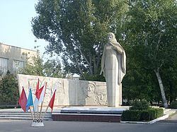
It was founded in 1799 by Armenian settlers from Derbent. During World War II, Budyonnovsk was occupied by German troops from August 18, 1942 to January 10, 1943.
The Budyonnovsk hospital hostage crisis took place here on June 1995.
Administrative and municipal status
Within the framework of administrative divisions, Budyonnovsk serves as the administrative center of Budyonnovsky District, even though it is not a part of it. As an administrative division, it is incorporated separately as the town of krai significance of Budyonnovsk—an administrative unit with the status equal to that of the districts. As a municipal division, the town of krai significance of Budyonnovsk is incorporated within Budyonnovsky Municipal District as Budyonnovsk Urban Settlement.
Military
An airbase is located 14 km (9 miles) northwest of the town.
Religion
On July 1, 2010, an Armenian apostolic church was opened in Budyonnovsk.