
Type Track | Length 401 km | |
 | ||
Route number(s) National Route 80 C80 (future route number) Via Judbarra / Gregory National Park, Victoria River Downs Station, Top Springs | ||
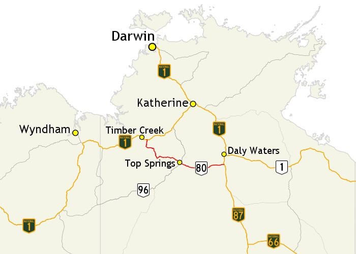
The Buchanan Highway, Northern Territory, Australia runs west from Dunmarra on the Stuart Highway crossing the Buntine Highway at Top Springs and eventually connecting with the Victoria Highway near Timber Creek. It is unsealed for its entire length, at 393 kilometres. Funding for maintenance is provided by the Northern Territory government.
Map of Buchanan Hwy, Northern Territory 0852, Australia
References
Buchanan Highway Wikipedia(Text) CC BY-SA