
Type Rural road | Length 570 km | |
 | ||
Route number(s) National Route 96 (WA/NT border – Victoria Highway) B96 (future route number in Northern Territory) Formerroute number National Route 80 (Nicholson – Top Springs) East end Victoria Highway (National Highway 1), Willeroo, Northern Territory | ||
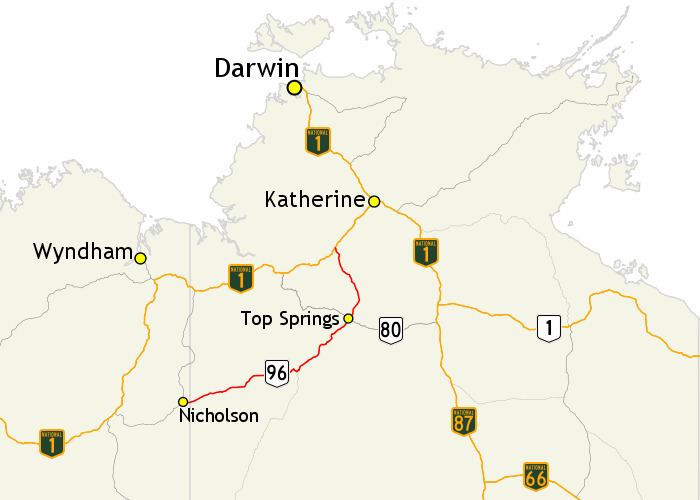
The Buntine Highway is a 570-kilometre highway in the Northern Territory and Western Australia. It runs from the Victoria Highway via Top Springs and Kalkarindji and then to Nicholson, Western Australia. The section from the Victoria Highway to Kalkaringi is a single-lane sealed road with a few dual-lane sections; the remaining section is unsealed. Funding for maintenance is provided by the Northern Territory government.
Map of Buntine Hwy, Australia
References
Buntine Highway Wikipedia(Text) CC BY-SA