
Area 863 km² | Max length 64.4 km | |
 | ||
Bubiyan Island (Arabic: جزيرة بوبيان) is the largest island in the Kuwaiti coastal island chain situated in the north-western corner of the Persian Gulf, with an area of 863 square kilometres (333 sq mi). The island is uninhabited.
Contents
Map of Bubiyan Island, Kuwait
It is separated from the Iraqi mainland in the northeast by Khawr Abd Allah and from the Kuwaiti mainland in the southwest by Khawr az-Zubayr. The latter channel trends around the northern end of Bubiyan Island, separating it from Warbah Island. 5.4 km (3 mi) northwest of Ras al Barshah, the southernmost point, Bubiyan is linked to the mainland by a concrete girder bridge over the Khawr as Sabiyah channel, 2.38 km (1.48 mi) long, built in 1983, which is for military use only. During the Persian Gulf War of 1991 the bridge was destroyed, but has been rebuilt. The island itself was converted to a military base in 1991 and has served as one ever since.
In November 1994, Iraq formally accepted the UN-demarcated border with Kuwait which had been spelled out in Security Council Resolutions 687 (1991), 773 (1992), and 833 (1993) which formally ended an earlier claim to Bubiyan Island.
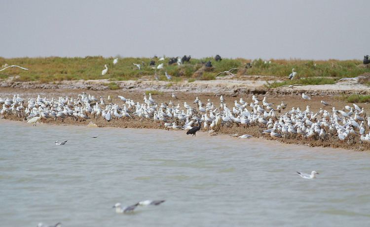
Mubarak Al-Kabeer ReserveEdit
In response to Kuwait becoming the 169th signatory of the Ramsar Convention, the Mubarak al-Kabeer reserve was designated as the country's first Wetland of International Importance. The 50,948 ha reserve consists of small lagoons and shallow saltmarshes and is important as a stop-over for migrating birds on two migration routes; Turkey to India and Eurasia to Africa. Breeding water-birds include the world's largest breeding colony of Crab-plover (Dromas ardeola), and the surrounding sea is major nursery for many commercial fish species.