
Elevation 455 m (1,493 ft) Time zone CET (UTC+1) Area 12.3 km² Local time Sunday 2:57 AM | Demonym(s) Bruzolesi Dialing code 011 Postal code 10050 Dialling code 011 | |
 | ||
Weather 3°C, Wind W at 14 km/h, 74% Humidity | ||
Bruzolo to val di susa
Bruzolo (pop. 1489) is a commune of the Metropolitan City of Turin in the Italian region Piedmont. Located some 43 kilometres (27 mi) west of Turin, in the lower Susa Valley, it is a member of the Comunità Montana Bassa Valle di Susa e Val Cenischia. Bruzolo borders the following municipalities: Usseglio, Condove, Chianocco, San Didero, and San Giorio di Susa.
Contents
- Bruzolo to val di susa
- Map of 10050 Bruzolo Metropolitan City of Turin Italy
- 8 n o t a bruzolo in musica
- References
Map of 10050 Bruzolo Metropolitan City of Turin, Italy
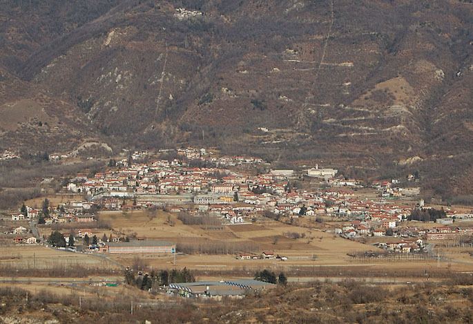
The town of Bruzolo is the main population centre of the commune and is its capoluogo. It stands to the left of the river Dora Riparia on an alluvial fan formed over the millennia by debris deposited by the Pissaglio and other minor torrents. The municipal territory also includes farmland and factories on the flood-plain of the Dora Riparia, and extends over the forested southern slopes of Punta Lunella, elevation 2,772 metres (9,094 ft), where there is a scattering of hamlets: Campobenedetto, Meisonardi, Comba, Bigiardi, Lunera, Coletto, Chiotetti, Seinera and Combette.