
Population 8,476 (2011) Postcode(s) 3057 Founded 1839 | Established 1839 LGA(s) City of Moreland Area 220 ha Postal code 3057 | |
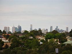 | ||
Location 6 km (4 mi) from Melbourne | ||
Brunswick East is an inner suburb 6 kilometres (3.7 miles) north from Melbourne's central business district. Its local government area is the City of Moreland. At the 2011 Census, Brunswick East had a population of 8,476.
Contents
- Map of Brunswick East VIC 3057 Australia
- Geography
- People
- History
- Commerce and culture
- Transport
- Landmarks
- Public open space
- Educational facilities
- Development issues
- Politics
- References
Map of Brunswick East VIC 3057, Australia
Bordered generally by Lygon Street and Holmes Street in the west; the Merri Creek in the east adjoining Northcote; Park Street, Nicholson Street and Glenlyon Road in the south adjoining Carlton North and Fitzroy North; and Moreland Road in the north adjoining Coburg. Brunswick East is a mixed-use suburb, consisting of primarily residential and commercial properties.
Geography
Lygon Street and Nicholson Street run along Brunswick East's western border with neighbouring Brunswick, while Park Street (one block south of the main thoroughfare of Brunswick Road) and Glenlyon Road form the southern border with Carlton North and Fitzroy North respectively. Merri Creek marks the eastern border with adjoining Northcote. Moreland Road marks the northern border with adjoining Coburg.
Brunswick East has a hillier landscape than Brunswick.
People
According to the 2011 Census, there were 8476 people were living in Brunswick East. The population rose from 7410 recorded in 2006, and 6845 in 2001.
The suburb has a higher proportion of people 18–34 years and a lower proportion of children 0–17 years and older people over 70 years, than the Moreland average. While cultural diversity is declining, just nearly one third of all citizens were born overseas which is substantially higher than the metropolitan average, although lower than the Moreland average.
In the 2011 Census, 65.5% of people reported speaking only English at home. The most common other languages spoken at home are Italian (9.2%), Greek (4.6%), Arabic (2.5%), Mandarin (1.8%) and Cantonese (1.0%), 39.4% of people identified as having no religion (markedly more than the state average of 24.0%), 26.5% as Catholic, 6.6% as Eastern Orthodox, 4.4% as Anglican and 2.8% as Buddhist.
Brunswick East has a high proportion flats, units, apartments or semi-detached, row, terrace or townhouses. Separate houses make up just over half of all dwellings. More than one in four households in Brunswick East are lone person households and 14 per cent are group households, which is higher than the Moreland and metropolitan averages. There is also a high proportion of rental households, which is significantly higher than the metropolitan and Moreland averages.
Residents of Brunswick East tend to be highly educated with 28 per cent having a bachelor's degree or higher, and over half of all residents having completed Year 12 schooling, significantly higher than the municipal and metropolitan averages. A high proportion of professionals work in Brunswick East, with declining numbers of labourers, trades, production and transport workers. Income data from the 2001 Census highlights that there are still pockets of disadvantage in the suburb with almost half of the citizens on weekly individual incomes of less than $400 per week, with 10 per cent of citizens on incomes of less than $120 per week.
History
In 1839 under the instructions of Robert Hoddle, chief surveyor, the area of Brunswick, including East Brunswick, was surveyed. Big blocks were marked out of 1½ miles long by 1/4 mile wide. The blocks were bought mostly by land speculators.
Bluestone quarrying was one of the first industries in Brunswick East. By 1852 the local stone quarries had been worked to the point of exhaustion.
Significant residential subdivision of the area took place in the 1880s (Brunswick East Post Office opening on 13 January 1888) and also in the period after World War I. In 1916, the tram along Lygon Street was electrified, making access much easier.
Brunswick’s first textile factory, Prestige Hosiery, opened in 1922, and the suburb became the location of numerous textile and garment factories. The textile industry has been in substantial decline in the suburb since the 1980s with the liberalisation and elimination of tariff controls by successive Federal Governments.
Redevelopment of commercial and industrial property has taken place for medium and high density housing, adding to the rich diversity of the area, promoting the opening of many new cafes bars and creative small businesses.
Commerce and culture
At the southern end of the Brunswick East strip of Lygon Street there is an increasing diversity of restaurants and cafés offering a variety of cuisines including: Italian, Greek, Lebanese, Vietnamese, Japanese, Indian, Thai, and Malaysian foods. This restaurant strip is quite separate from the longer established "Little Italy" strip of restaurants and street cafés further south in Lygon Street, Carlton. At the northern end of the Brunswick East strip of Lygon St is a neighbourhood strip with a mixture of community, retail and entertainment venues. Between the two, Lygon Street is predominantly light industrial buildings undergoing a process of redevelopment to mixed-use. The East Brunswick Club Hotel became popular in the mid-2000s as a music venue.
Community radio station 3RRR moved from Fitzroy to the corner Blyth and Nicholson Streets in late 2004, opposite another music venue, the Lomond Hotel. Although it has very good tram access to the city, Nicholson Street is a mixture of underutilised industrial properties and free-standing houses on large blocks, with very little retailing or commercial uses occurring.
Transport
Commuters to the city use buses and trams.
Three tram lines service Brunswick East:
Several bus routes travel east-west through the suburb, including:
Cyclists have available many, on road cycle lanes as well as easy access to the Merri Creek Trail along Merri Creek. On the southern edge of the suburb the old Inner Circle railway line is now a linear park which is a part of the Capital City Trail for pedestrians and cyclists. This trail connects the Merri Creek Trail to the Moonee Ponds Creek Trail in the network of pedestrian and bicycle shared use paths for Cycling in Melbourne.
Landmarks
The CERES Community Environment Park (Centre for Education and Research in Environmental Strategies) is a 10-acre (40,000 m2) urban environmental centre located in Brunswick East's eastern border.
Public open space
East Brunswick has several parks and reserves of varying size as well as the Merri Creek corridor which is managed by a long-standing community group and has a popular bike path connected to the main Yarra Trail. The public open space forming part of the Merri Creek corridor or directly accessible from it includes:
Within the built-up area of East Brunswick, public open space includes:
Educational facilities
Brunswick East has two government primary schools, Brunswick East Primary School (BEPS) and Brunswick South Primary School (BSPS), and a Catholic primary school, Our Lady Help of Christians, while the nearest high school is in Northcote. Brunswick East Primary School opened in 1893, and renovated in 1922, the early 1970s and 1997. CERES provides courses about environmental sustainability.
Development issues
Brunswick East is an area in transition. Lygon Street and parts of Nicholson Street are its main activity centres, with a mix of commercial, retail, community and light industrial in the former, and a bias towards light industrial and residential in the latter. Rises in land values due to gentrification, have resulted in many of the industrial uses vacating their buildings, which have become attractive to developers of medium and higher-density residential projects, often with a small commercial or retail component. Many of these projects have been contentious among the local community, the most notable being a proposal for a 16-storey tower immediately to the north of a Maternal and Child Health Centre. Local groups such as the Brunswick Progress Association have been active in anti-development campaigns, along with the local branch of Save Our Suburbs, Brunswick Residents Against Inappropriate Development. In 2006, Moreland City Council commenced a consultative process to develop a Structure Plan for the Brunswick Major Activity Centre, whose study area incorporates Lygon Street, Nicholson Street and much of the adjoining suburb of Brunswick.
Politics
The area has traditionally been considered an Australian Labor Party stronghold, although with recent demographic changes the area has contributed to the election of an Australian Greens Party Councillor to the Moreland Council in 2001, 2004, 2008, and again in 2012.
At federal level, Brunswick East is within the Division of Wills, held by Kelvin Thomson of the ALP since 1996.
In the Victorian Legislative Assembly, Brunswick East lies within the Electoral district of Brunswick, which is held by the ALP member Jane Garrett. For the 1999 state election, the suburb lay in the Electoral district of Coburg.
Brunswick East was a part of the City of Brunswick local government area until the latter was amalgamated with councils to the north to make the City of Moreland in 1994.
Polling place statistics are presented below combining the votes from the Brunswick East and Brunswick South East polling places in the federal and state elections as indicated.