
ZIP codes 41016-41017 Elevation 155 m Local time Friday 11:40 PM | Time zone Eastern (EST) (UTC-5) FIPS code 21-09856 Population 804 (2013) Area code 859 | |
 | ||
Weather -2°C, Wind N at 0 km/h, 62% Humidity Area 104 ha (78 ha Land / 26 ha Water) | ||
Ns 143 southbound at bromley kentucky
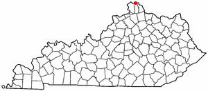
Bromley is a 5th-class city along the Ohio River in Kenton County, Kentucky, in the United States. The population was 838 at the 2000 census.
Contents
Map of Bromley, KY, USA
Geography
Bromley is located at 39°4′57″N 84°33′36″W (39.082610, -84.560088).
According to the United States Census Bureau, the city has a total area of 0.4 square miles (1.0 km2), of which 0.3 square miles (0.8 km2) is land and 0.1 square miles (0.3 km2) (26.19%) is water.
Several Bromley streets bear the names of prominent Kentucky historical figures, including Shelby Street (Isaac Shelby), Boone Street (Daniel Boone) and Kenton Street (Simon Kenton).
History
The settlement of Bromley can be traced to 1784, when Prettyman Merry received a land grant from the United States Government of 2,000 acres (8.1 km2). Soon thereafter, the Merry family began constructing a home on the property. This home still stands today on Shelby Street.
The Commonwealth of Kentucky officially approved the incorporation of the City of Bromley on May 23, 1890.
Demographics
As of the census of 2000, there were 838 people, 342 households, and 221 families residing in the city. The population density was 2,702.8 people per square mile (1,043.7/km²). There were 362 housing units at an average density of 1,167.5 per square mile (450.9/km²). The racial makeup of the city was 98.57% White, 0.48% Native American, 0.36% Asian, 0.12% from other races, and 0.48% from two or more races. Hispanic or Latino of any race were 0.48% of the population.
There were 342 households out of which 30.4% had children under the age of 18 living with them, 43.0% were married couples living together, 15.5% had a female householder with no husband present, and 35.1% were non-families. 29.8% of all households were made up of individuals and 12.6% had someone living alone who was 65 years of age or older. The average household size was 2.45 and the average family size was 3.07.
In the city, the population was spread out with 26.5% under the age of 18, 9.5% from 18 to 24, 30.7% from 25 to 44, 19.1% from 45 to 64, and 14.2% who were 65 years of age or older. The median age was 34 years. For every 100 females there were 94.9 males. For every 100 females age 18 and over, there were 91.9 males.
The median income for a household in the city was $31,563, and the median income for a family was $40,481. Males had a median income of $30,486 versus $24,886 for females. The per capita income for the city was $14,315. About 10.3% of families and 11.1% of the population were below the poverty line, including 9.9% of those under age 18 and 9.2% of those age 65 or over.