Supriya Ghosh (Editor)

Brody Raion

Updated on
Edit
Like
Comment
Share on FacebookTweet on TwitterShare on LinkedInShare on Reddit
Country
  
Ukraine

Time zone
  
EET (UTC+2)

Area
  
1,157 km²

Administrative center
  
Brody

Subdivisions
  
76

Admin. center
  
Brody

Area code
  
380-3266

Population
  
59,225 (2016)

Region
  
Lviv Oblast

Brody Raion httpsuploadwikimediaorgwikipediacommonsthu

Website
  

Brody Raion (Ukrainian: Бродівський район, translit: Brodivs’kyi raion) is a raion (district) of Lviv Oblast (region) of Western Ukraine. Its administrative center is Brody. Population: 59,225 (2016 est.).

Contents

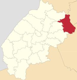
Map of Brodivs'kyi district, Lvivska, Ukraine

The raion is located at the easternmost portion of the Lviv Region bordering with Rivne and Ternopil regions to its east, Volyn region to the north, Radekhiv district to the northwest, Busk district to the west, and Zolochiv district to the southwest.

Historically, the district (county) became known as border checkpoint between the Austria-Hungary Empire and the Russian Empire. As a county (powiat) it was established in 1866 as part of the Kingdom of Galicia and Lodomeria. After the World War I the area became part of the Second Polish Republic within the Tarnopol Voivodeship. During the World War II, during the invasion of the Soviet forces, the district was established by the Soviet administration.

The raion has a city administrative area, a "town with three other villages" administrative area and 23 rural councils which are formed out of the rest of the 73 villages. Some councils include up to 10 villages (Ponykva), while some consist only of a pair of villages.

Landmarks of Architecture

  • Ruins of the Brody Castle, built by Guillaume Le Vasseur de Beauplan (1630-1635)
  • Church of Vozdvyzhenia Chesnoho Khresta (former kosciol, 1660)
  • Church of the Nativity of the Virgin Mary (18th century)
  • Church of Saint George (18th century)
  • Church of Holy Trinity (1750s)
  • Ruins of Brody Synagogue (1750s)
  • Jewish Cemetery in Brody
  • Pidhirtsi Castle, built by Beauplan
  • Castle's kosciol
  • Inner court with a solar clock
  • Castle's garden
  • Church of Saint Michael (18th century)
  • 400-year-old linden tree
  • Plisnysko Gord
  • Order of Saint Basil Monastery (18th century)
  • Monastery UGCC (earlier Dominican Order) (Pidkamin')
  • Building of kosciol
  • Monastery cells
  • Defensive walls and bastions
  • Corinth column with a statue of the Virgin Mary
  • Several towns chapels
  • Dominican cemetery
  • 17-meter tall rock, leftover of a sea reef
  • Wooden kosciol of Yazlivchyk (1930s)
  • Potocki Palace in Konyushkiv (18th century)
  • Cossack cemetery near Shnyriv (1651)
  • Kosciol ruins of the former Order of Saint Bernadine Monastery
  • Education

  • Markian Shashkevych Brody Pedagogical College
  • Health Care

  • Brody Central District Hospital
  • Pidkamin City Hospital
  • Zabolotsi District Hospital
  • Dental Clinic
  • References

    Brody Raion Wikipedia