
Topo map USGS Briones Valley Country United States of America | Elevation 430 m | |
 | ||
Similar | ||
The Briones Hills form a low mountain range in western Contra Costa County, in the East Bay region of the San Francisco Bay Area, California, United States.
Contents
Map of Briones Hills, California 94553, USA
Geography
The hills are in the Southern Inner Coast Ranges group of the California Coast Ranges System.
Cites and towns adjacent to or in the foothills of the range include: Lafayette, Martinez, Orinda, Pleasant Hill, Alhambra Valley, and Walnut Creek.
Features
Briones Regional Park, in the East Bay Regional Park District System, provides hiking trails for access. It also protects some of the range's California oak woodland, chaparral, and riparian habitats.
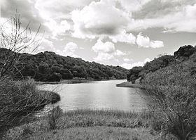
Briones Reservoir, of the East Bay Municipal Utility District (EBMUD), is located in the western area. It is impounded by Briones Dam on Bear Creek.
The headwaters of Pinole Creek are in the Briones Hills, on the western slope of Costa Peak. The headwaters of Alhambra Creek are in the hills within Briones Regional Park.