
 | ||
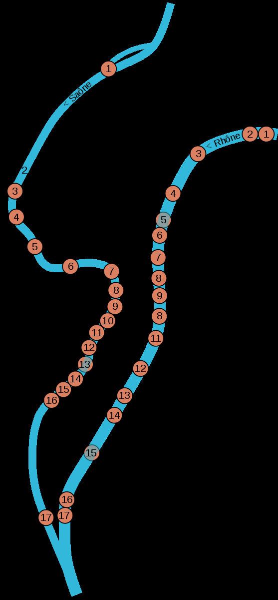
This is a list of bridges in the French city of Lyon on the Rhône and Saône rivers, ordered from upstream to downstream portions of the river.
Contents
- Bridge Raymond Poincar 1939 1989
- Viaduc SNCF 1857
- Pont Winston Churchill 1982
- Pont de Lattre de Tassigny 1956
- Pont Morand 1976
- Gateway College 1844
- Pont Lafayette 1890
- Pont Wilson 1918
- Guillotire the Bridge 1953
- Bridge University 1903
- Pont Gallieni 1965
- Perrache Viaduct 1856
- Pont des Girondins in development
- Pont Pasteur 1949
- Passerelle de la Paix 2014
- le Barbe 1827
- Pont Schuman
- Passerelle Masaryk 1831
- Clemenceau Bridge 1952
- Knig Bridge 1972
- Passerelle de lHomme de la Roche 1989
- Passerelle Saint Vincent 1832
- Feuille the Bridge 1949
- Bridge Change disappeared and bridge Marchal Juin 1973
- Passerelle du Palais de Justice 1983
- Pont Bonaparte 1950
- Passerelle Paul Couturier 1853
- Ainay Bridge defunct
- Pont Kitchener Marchand 1959
- Viaduct A6 1971
- Viaduct Quarantine 1856
- Ponts de la Mulatire 20th century
- References
Bridge Raymond Poincaré (1939-1989)
This bridge is counted among the bridges of Lyon even though it is located outside of the physical limits of the city. The right bank is located in Caluire-et-Cuire, with the left in Villeurbanne.
The bridge was built in conjunction with the establishment of Belt Boulevard initiated by the President of the General Council Bonnevay Lawrence, a roadway that bears his name. The bridge itself is dedicated to Raymond Poincaré, President of France from 1913 to 1921, and Prime Minister from 1926 to 1929, during the devaluation of the French franc—a point in time where the franc became known as the franc Poincaré due to its decreased value. Construction of the bridge began in 1937 as a classic concrete arch bridge, for both road and rail traffic, with 4 batteries. While World War II slowed work on it, construction on the bridge continued through 1940 when an attack by German forces destroyed the bridge's roadway. Despite the setback, construction on the structure resumed shortly after the assault. Towards the end of the war, retreating German forces again destroyed the bridge by dynamiting the structural arches.
The bridge was rebuilt in 1950; but during an inspection, cracks were found in the structural concrete of the bridge and it had to be closed to traffic. After four years of repair work the bridge was reopened in 1954. Again, after a period of just 10 years, more cracks appeared below the railroad tracks. The bridge was replaced by a temporary steel structure that remained in place until the reopening of the bridge in its current state in 1989. More recently, both ends of the bridge have been widened and modified to connect to an interchange north of the structure and to a large traffic circle at Belt Boulevard.
Viaduc SNCF (1857)
The cast-iron railway bridge was built from 1854 in 1857 to support the Lyon-Geneva, which merged in 1857 with the Chemins de fer de Paris à Lyon et à la Méditerranée (PLM). Today it allows passage by the tunnel Collonges to the west of France and to Paris. For a few meters It is parallel with the road bridge Raymond Poincaré.
The batteries are still based on piles driven into the Rhône and the construction of the Cité Internationale de Lyon, which narrowed the bed and increased the water level was during a recasting of Complete strengthening their bases protected by massive concrete. In 1856, when the work was very advanced, they were detained on suspicion of the bridge and dam have increased the level of the flood. It required the manufacturers to replace the western edge of the dam which limit the Parc de la Tête d'Or by several spans for the passage of water. This provision is still very visible.
Damaged by the Germans in 1944, it was completely reopened to traffic in 1946.
Pont Winston Churchill (1982)
In 1862, the Marshal de Castellane is a bridge made of boats to connect the Grand Camp (La Doua) to the camp of Sathonay. This bridge is replaced by driving a metal which is carried out in 1874.
In 1899, also a new bridge-type metal, with an unusual figure in Lyon because it consists of two major airlines arches, resting on two intermediate replace batteries as theBridge Loop, because of the large curve that describes the Rhone against the balmes Caluire. 280 m long with a small width (10.80 m) to only 5.40 m carriageway, flanked by two streets of 2.70 m (8 ft 10 in). This caused his narrow loss. It does more than a limited volume to 7.5 tonnes, which is very inadequate for the needs of traffic.
Rebuilt after the bombing of 1944, it reopens in 1946 and it was renamed the bridge Winston Churchill January 28, 1966. It was finally demolished in 1981 and replaced by the current concrete deck in 1982.
Pont de Lattre de Tassigny (1956)
A first bridge, the bridge Egyptian, was thrown on the Rhone in 1846. The origin of its name came from the Egyptian eight columns that supported the bridge cables. It was 200 m long with a roadway of 4.80 metres surrounded by two streets of 1.10 m (3 ft 7 in). This structure, renamed the bridge to Louis-Philippe 1849, was carried by a mill during a flood in 1854.
The bridge reopened to the public on March 30, 1856. Built in a style more sober, it is also slightly narrower (4.90 m roadway and two sidewalks of 90 cm). Called Bridge St. Clair (as in 1875), it is renowned bridge Vaïsse December 21, 1931 in tribute to Claude-Marius Vaïsse.
In 1952, the digging of the tunnel de la Croix-Rousse is completed, then destroy the bridge Vaïsse in 1953 and are reconstructed in 1956 a little further down in alignment of the tunnel a new bridge named in honour of Jean-Marie de Lattre de Tassigny. The concrete bridge is 150 m long and 25 m wide (20-metre carriageway and pavements of 2.50 m).
Pont Morand (1976)
Originally built in wood, by the architect planner Jean-Antoine Morand Jouffrey in 1774, it is the second oldest bridge over the Rhone. It is 208 m long and 12 m wide It has several names: Pont Saint-Clair, bridge or Red Wood originally Affranchi bridge in 1793, deck wins in 1794, then Morand bridge (as in 1810). In 1825, the bridge collapses and is replaced by a flying bridge during reconstruction of the bridge. In 1854, it is resistant to flood the bridge carries St. Clair strikes the bridge piers of Morand and block the flow of water.
But in the 1880s, the bridge collapse vétuste threat and should be restricted to traffic. In the 1890, it is replaced by a metal bridge structure based on piles of masonry. It is 214.50 m long, with a surface of 11 m and two sidewalks of 4.50 m (15 ft). The central arch is destroyed by the Germans in 1944. On 3 February 1945, a temporary wooden bridge, the bridge building, is open to allow traffic for the reconstruction of the bridge Morand. It consists of a deck of 205 m based on ten cells on stilts. The final bridge is reopened on 3 April 1948.
It was demolished in turn, 1974 in connection with the subway. In 1976, the current bridge in concrete along 187 m is inaugurated. It allows the metro to move within the apron, while cars and pedestrians are on the surface on a surface of 15.50 m wide and two sidewalks of 2 m . Originally designed as the first of two twin bridges, it is in alignment with the draft of the breakthrough Martinière-Morand, unlike the previous bridge, which were in line with the current Franklin-Roosevelt (former course Morand). This project has been abandoned, the second bridge Morand was never built.
Gateway College (1844)
This bridge takes its name from the Lycée Ampère because it leads right bank on the passage Ménétrier included in the college of the same name, formerly called the 'Great College in the Old Regime the 'Small College is the square of the same name in the Old Lyon.
It was built on the pressure of population on the left bank which had no public high school (the girls did not appear at the end of XIX ((e)) century and the Parc after the war 1914), the bridge allowed the students not to take detour bridges Morand'or'Lafayette and cross safely.
The company bridges of the Rhone was still setting in 1842 and was required to achieve and a project is approved as early as July. The bridge in "son of Iron" is always based on three rock piles which are renewed from time to time and has three spans of 96 m at the center and 42.5 m on the sides with a width of 4 m (13 ft).
The construction was marked by a tragic incident, the work was nearing completion when 7 December 1844 a bolt holding a cable in its sheath broke. The bridge collapsed and 8 workers drowned. Work restarted immediately and put on the book travel on September 3, 1845.
The bridge was partially destroyed in 1944, a battery was rebuilt almost identical in stones (the middle one bears a commemorative inscription). The bridge is finally open to the public on September 3, 1945, since the passage of pedestrians quai Jean-Moulin au quai Général-Sarrail is busy.
Pont Lafayette (1890)
This is the third oldest bridge on the Rhone. In 1826, is first constructed a bridge, the Pont Charles X or Bridge Concert from 1828. 214 m long and 13 m wide, it consists of a timber resting on abutments and piers of masonry.
On 5 September 1829 Lafayette made a triumphal entry into Lyon via the bridge was renamed in his honour on 19 September 1830. It is washed away by floods in 1840, then 1856.
Too old, it is replaced in 1890 by the current bridge, with steel structure resting on stone piers Porcieu-Amblagnieu. The central arch, which was destroyed in September 1944, the bridge was rebuilt and reopened in 1946.
Pont Wilson (1918)
The first bridge, the bridge of the Hôtel-Dieu or Hospital, was built in 1837–1839 by the contractor Clauzel, on behalf of the company of bridges of the Rhone. This was a suspension bridge with a length of 210 m (689 ft), based on solid concrete piers, protected by riprap.
In 1887, the condition of the bridge was considered dangerous and it was finally demolished in 1912. It was replaced by a temporary wooden bridge, then by the Wilson Bridge, inaugurated on 14 July 1918. The new bridge was much wider than the former (20 m against 7), and the sidewalks pass the 1.10 m to 4.50 m (15 ft). A revolutionary structure for the period, it has a reinforced concrete deck resting on piers of stone masonry in the Villette. The bridge was damaged in September 1944 and finally reopened in 1948.
Guillotière the Bridge (1953)
The bridge of the Guillotière, also formerly known as Rhône Bridge is the oldest bridge over the Rhone. The bridge from the Middle Ages was based on a forest of oak piles, which have made the digging of the subway tunnel, in the 1980s. Some arches have been filled on the left bank, in the 1820s. This explains the anomaly which Lyon is known as Place du Pont (now Place Gabriel Péri) a place that is a hundred metres from the top deck. The bridge was destroyed during the retreat of the German army in September 1944. It was demolished in 1952 and replaced by a wider bridge, with a metallic structure in 1953.
Bridge University (1903)
This bridge was built at the site of an old ferry to serve the university buildings erected between 1876 and 1898. When it opened in 1903, the bridge was named book of the faculties, but it was quickly renamed the University Bridge. Damaged in 1944, a temporary wooden bridge is established, then the bridge was finally reopened in 1947. The bridge, along 267.50 m to 20 m wide, consists of three arches in Longwy molten metal and resting on stone piers Porcieu-Amblagnieu.
Pont Gallieni (1965)
A project, outlined in 1830, envisaged the construction of an east-west axis, consisting of either side of the current course of Verdun of a bridge over the Saône (now Kitchener-Marchand bridge) and two bridges over the Rhône . These crossings are appointed every two bridge Seguin, was completed in 1847 and open to the public in 1849.
The new bridge over the Rhone is composed of two shares constructed and others Bechevelin Island. The main bridge over the Rhone is composed of two piers supporting a central span of 60 m long and 7.4 m wide by two side spans respectively 39 and 67 m (220 ft). He took the name of Napoleon bridge, then bridge Séguin (1849), Rhone bridge (1852) and the Midi bridge to 1871. That same year, the Lône Bechevelin is filled.
The main deck in a very poor state was destroyed in June 1889. It was rebuilt between 1889 and 1891. As Morand and Lafayette bridge built at the same time, this new bridge has three arches of metal. It is 20 m wide and 209 m (686 ft). long It was inaugurated on 13 July 1891 under the name du Midi bridge, but it was renamed Gallieni July 17, 1916. It was destroyed in 1944, rebuilt, and finally demolished in 1962–1965 to be replaced by a steel bridge larger (28.5 m) but shorter (204, 8 m), inaugurated on 30 October 1965. Since 2001, the number of lanes to traffic has been reduced to bring the two lines of tram T1-T2.
Perrache Viaduct (1856)
This railway bridge was built between 1852 and 1856 to link Gare de Lyon-Perrache and Gare des Brotteaux. It is also referred to as the bridge of the Mediterranean 'because it is part of the artery "imperial" of Chemins de fer de Paris à Lyon et à la Méditerranée (PLM).
It was first built on 2 channels at the same time as the tunnel is drilled Saint Irenaeus to link the Perrache train station in station Vaise, and beyond Paris-Gare de Lyon.
Its cast iron arches made Givors are based on batteries sitting on piles under the old techniques, but renewed and strengthened several times, especially when doubling its steel in 1926. It was only slightly damaged in 1944, first on 26 May by a bomb ally, then by the German artificers.
In the early days of the Liberation, the Americans remblayèrent tracks remained in place to move convoys heavy vehicles onto the deck with ramps installed at the station of Perrache.
Pont des Girondins (in development)
A proposed new crossing of the Rhône is envisaged under the Lyon Confluence project. It would link Perrache and Gerland up to the rue des Girondins. The main obstacle to the construction of this structure is the presence of the A7 on the banks of the Rhone at Perrache.
Pont Pasteur (1949)
A first provisional structure, the bridge of the Exposition, was built for the Universal Exhibition in Gerland in 1914.
This gateway then took the name of the bridge Slaughter. It is carried away by a flood in October 1918. A new bridge with three arches, built entirely of reinforced concrete, was built to replace it. He was baptized bridge Pasteur by the City Council at its meeting of 5 March 1923 and was finally inaugurated on 14 July 1923.
225 m long, it has very wide sidewalks (5.25 m for a road of 11 m). The bridge is severely damaged by the Germans in 1944. The current bridge was built to replace it. Inaugurated in 1950, this book is less long (195.25 m) but larger (more than 18 m), however the streets are reduced to a width of 3.32 m (11 ft).
Passerelle de la Paix (2014)
The Passerelle de la Paix (skyway of peace) is a 220-metre (720-foot) long pedestrian and bicycle bridge over the Rhône river. It was designed by architect Dietmar Feichtinger and opened to the public in March 2014. It connects the 6th arrondissement of Lyon and the commune of Caluire-et-Cuire.
Île Barbe (1827)
The suspension bridge built on both sides of the tip of Île Barbe was originally built in 1827 by Marc Seguin (himself a Lyon resident, born in the Ainay district of Lyon) on the site of an old bridge that was formerly known as the Pont Cotton (attested in the 17th century).
It is the oldest surviving bridge structure in Lyon ; its construction was followed by that of the Pont de Couzon (1840) and the Passerelle Saint-Georges footbridge (1853; later renamed Passerelle Paul Couturier), the pillars of which are shaped like silk weavers' shuttles.
Pont Schuman
A new crossing of the Saône was completed in 2014 to connect the Vaise neighbourhood (in the 9th arrondissement) to Serin (in the 4th arrondissement). This new bridge, named after Robert Schuman, was built upstream of the Pont Masaryk, which is restricted to pedestrian and cyclist use only. The Pont Schuman is built as an extension of the Rue de la Gare d'Eau. It was opened to traffic on the 5th November 2014 to the accompaniment of a sound and light show.
Passerelle Masaryk (1831)
This suspension bridge, funded by the residents is open to the public May 17, 1831. It consists of two spans retained by guy wires attached to three piles of stone Couzon, openness equal 85.20 m (280 ft); cables, repeatedly renewed, support apron 6.50 m wide, two sidewalks of one metre. Limited to 2.5 tonnes it supports without problem sometimes one, sometimes two lanes of traffic, according to the necessities of the traffic sector.
It was originally bridge Vaise (as in 1838) or bridge station Vaise (as in 1842) with reference to the water station in use in this district of 1830 in 1974. Its current name was given by 1 ((er)) January 1931 in honour of Tomáš Masaryk (1854–1937), founder of the Czechoslovak Republic and friend of Édouard Herriot.
Almost identical construction of the bridge to the Ile-Barbe. He was, in fact, built shortly after him and with the same construction technique. Its usefulness was related to the presence a little upstream right bank of the water station set up in 1827 for the needs of inland navigation and that can not be replaced until 1966 by the cuttings of tunnel Fourviere.
The central pier laid some foundation problems because it is based on piles of wood protected by rocks that must be periodically strengthened, but it has stood since all raw and even German artificers in 1944.
Its elegant silhouette has not changed since the original appearance and is the oldest of all the bridge piers of the city, it is also one of the heritage of this part of the city which marks the entrance to the urban heart of Lyon.
Clemenceau Bridge (1952)
In 1847, a first bridge, the bridge Mouton, was built on the Saône between Vaise and Serin. Damaged by bombing in 1944, it was rebuilt after the war. Vaïsse the bridge, it was destroyed in 1952 and replaced by a new bridge built in the alignment of the tunnel de la Croix-Rousse, the current bridge Clemenceau architect of the victory of 1918, chief negotiator of French Treaty of Versailles.
Built in steel, flat, it consists of three unequal spans (64.25 m in the centre, 39.80 m (131 ft), right bank, left bank 35.25 m (116 ft).) and its width is 25 metres, including 18 for the road . Bunkers were built on both sides, which was a first in Lyon.
This bridge was to remain a major traffic by extending urban elevated highway at the first floor of the street Marietton, a famous LY envisaged in 1950 but they were quickly abandoned .
Since the completion of peripheral North, it was reduced to two lanes passing car on the street Marietton). This project helps us understand the shape and rather unsightly piles that extend outside of the road because they had to accommodate the foundations of the bridge above.
Kœnig Bridge (1972)
A first bridge, the bridge deck or Serin Halincourt (as in 1789) is built by Degerando between 1745 and 1749, on behalf of Hospices Civils de Lyon, owner of the work. The bridge collapses in 1780 and is replaced by a wooden bridge, composed of seven arches, which is in turn carried by a flood of Saône on 17 January 1789. It is replaced by a new wooden bridge wide by just over 9 m and consists of five arches, built from 1811 under the direction of the engineer Kermengan and inaugurated on July 2, 1815. In 1844, the wooden hangers, old, are being replaced by stone arches. Very little damaged by the Germans, it was quickly reopened after the war.
Incompatible with the requirements of river traffic in view of the layout of the axis Rhin-Rhône, it was demolished in 1968. It is replaced in 1972 by a new steel bridge, the bridge Kœnig, 108 m long and consists of a single arch. This bridge has a roadway of 14 m and two sidewalks of 2.50 m (8 ft 2 in).
Passerelle de l'Homme de la Roche (1989)
A bridge was built in 1911–1912 between the quai Saint Vincent and the Place de l'Homme de la Roche. Along less than 100, the bridge consists of a 5 m road and two sidewalks of 1.25 m (4 ft 1 in). He is the only bridge, the bridge with St. Vincent, not to be destroyed in 1944 by German forces, so it allows the 1 st division French free to return to Lyon on September 3, 1944 to liberate the city. Considered too old and dangerous, it was demolished in 1986–1987. It is replaced in 1989 by a temporary metal bridge, made in Villefranche-sur-Saône and sent by barge. But this bridge has the particularity to finish almost in cul-de-sac at the foot of a hill next to Croix-Rousse and the other from that of Fourviere, Reconstruction Bridge is not really considered urgent and temporary pedestrian bridge is still in place.
Passerelle Saint-Vincent (1832)
The first bridge built in 1637 by the engineer Jean Christophe Marie, is swept away by ice in 1643. A new bridge replaces the 1656, but he knows the same fate as his predecessor in 1711. It is again replaced in 1777 by a new bridge, along with less than 80 m wide and 7 m (23 ft). In the 1830s, a project is developed to replace the bridge Saint-Vincent, too old and poorly placed. It proposes to build a new bridge further downstream and to replace the bridge Saint Vincent by a simple bridge. In 1827, it gives the company Tarpin the task of building the two books. The Saint Vincent bridge is open to the public at the end of the year 1832. In 1840, the bridge deck was damaged by flooding. It was repaired and did not need major work since then. The bridge is 76.50 m long and 2.80 metres wide
Feuillée the Bridge (1949)
The first bridge over the Feuillée is open to the public on 28 September 1831. 7 m wide, it consists of a central span of 67 m based on two batteries located near the banks. Damaged during floods in 1840, it was rebuilt and reopened on 21 November 1841. In 1887, its status is of concern, but it was not until 1910 to be demolished. Two years later, a new metal structure with piles of stone Porcieu-Amblagnieu is built. In 1936, a barge struck a pile of the bridge collapses, taking with him most of which eventually drowned bystanders. It is then replaced by a steel arch bridge multiple totally destroyed by the Germans in 1944. The engineer Mogaray rebuilt in 1949 a wider bridge, consisting of two cantilever s embedded in the culée s of shore covered with stones.
Bridge Change (disappeared) and bridge Maréchal Juin (1973)
The first bridge over the Saône was built around 1070 using stones from the ruins of ancient Fourviere and Croix-Rousse. Enshrined in 1076 by Humbert, the archbishop of Lyon, it connected the two sides of the city: on one side, rue Mercière and the Church of St Nizier; on the other, the Exchange, at the heart of Vieux Lyon, in which fairs were held and commercial transactions conducted. This stone bridge was composed of eight strong arches anchored on the rocky bed of the Saône. Located near the left bank, a single arch, called "the wonderful Ark" (or the Ark of Wonders) or "deceptive rapid of death", allowed the passage of ships. The entrances of the bridge were covered with three to four storey houses and houses primarily of goldsmith s. At the centre, a chapel was once erected, though this was replaced in the early nineteenth century with a niche for firefighters.
In 1842, the bridge was demolished. It was replaced in 1847 by a new bridge built a few meters downstream, and more compatible with the requirements of inland waterways. The following year he extended thanks to encorbellements and password to a width of approximately 14.5 m (48 ft). Over the centuries, it changed its name several times: Pont de Pierre (attested as early as the thirteenth century (()), but also as late as 1810), pont de Saône (around 1680), bridge Nemours (name attested in 1844 and officially awarded on 15 January 1852), Liberty Bridge (circa 1849). Ultimately, the name 'the Exchange bridge', attested from the eleventh century, was the one which remained.
Because it was seen as too difficult to navigate and did not satisfy changing traffic needs, the bridge was demolished in 1974 and replaced by the bridge Maréchal Juin built 200 m downstream to be in alignment Street Grenette. The new bridge, designed by the architect Gilbert Lamboley, was built between 1971 and 1973 under the direction of the engineer Merlin. It was inaugurated on 8 December 1973. 131.80 m long, it has a surface of 14 m (46 ft), surrounded by streets of 4 m (13 ft).
Passerelle du Palais de Justice (1983)
A first bridge appears to have been established in 1638 at this location. Consists of ten arches, it was destroyed in 1778 because of its disrepair. It is replaced in 1780 by a bridge consisting of a chain of twelve vessels, of which two mobiles. Volant commonly named bridge, it is also known as Forest or bridge deck Célestins. The flying bridge is washed away in part by the melting ice on 18 January 1789, then completely during the winter 1795.
It is replaced in 1797 by a wooden bridge built at the initiative of William Niogret. This keeps the bridge name bridge driving, but it is also called the Pont Neuf. It is damaged by the fallout of fireworks in 1820, then by the flood of 1824. It was finally destroyed in 1833 and replaced by a bridge built by the company in Seguin 1833–1834 to serve Palais de Justice . The central arch, with a range of 90 m (295 ft), is destroyed by the flood of 1840. The bridge, rebuilt in 1844, is composed of two batteries anchored near the shoreline which are based on an ark Central 47.70 m by two side spans of approximately 20 m (66 ft). The width of the new bridge is 4 m and two sidewalks of 1 m (3 ft 3 in). The central arch was destroyed by German forces in September 1944. The bridge was reopened in January 1945.
Service Navigation obtained in 1968 the destruction of the bridge of Change and the Bridge of the Palais de Justice bridge replaced by the Marshal in June 1983, was inaugurated a new bridge designed by Gilbert Lamboley. 4 m wide, its span of 136 m is suspended by cable stays planted in a single mast anchored on the left bank of the River.
Pont Bonaparte (1950)
The first wooden bridge, the bridge of the Archdiocese (or wooden bridge, county, or Bellecour Canons), was built between 1634 and 1642 by the engineer Jean Christophe Marie. The bridge is regularly hit by floods and 1709 five arches and four blade s are removed. The bridge was rebuilt in 1732 to be demolished 49 years later. Work to begin a new bridge, but they are regularly interrupted. The construction actually begins in 1786 to finish 1807 under the direction of the engineer Carron. The City Council named the bridge structure Tilsit. Built in stone Villebois, the bridge consists of five arches reaching 148 m in length. The pillars of the bridge based on rocks from the excavation of the dock Pierre Scize. The route of the "highway of Provence" is diverted from the deck of the Bridge to Change Tilsit. The bridge, too low, turns into a dam during the frequent floods of the Saône. It is demolished and replaced by a bridge built in the highest 1863–1864.
In September 1944 the German forces dynamitent the bridge loses its arches and from batteries. Too damaged, it is replaced by the current bridge built between 1946 and 1950. It is composed of three arches of reinforced concrete covered with stone Hauteville. Its current name was given on 27 January 1964.
Passerelle Paul Couturier (1853)
Once calledbridgeSaint-Georges, this book connects Ainay and Saint George is open to the public on ((date | 21 | October | 1853)) . It consists of a span of 87 m suspended by cables attached to poles anchored in the two batteries located 10 m from the shore.
Destroyed in 1944, the bridge was rebuilt to the same. The ((date | 17 | March | 2003)), it is renowned Paul Couturier bridge in honor of the priest, born in the Guillotière on ((date | 29 | July | 1881)) and d. ((date | 29 | March | 1953)), which contributed to the Interfaith trade
Ainay Bridge (defunct)
The first wooden bridge was built in 1745–1749 by Degerando on behalf of Hospices Civils de Lyon at the confluence of the Rhône and the Saône (before the decline of the latter more south in the 1780s). He was baptized bridge Ainay, Carron or Arsenal. It was damaged by floods in 1791 and especially by the seat of Lyons in 1793, notably by the explosion of the arsenal. The bridge is carved by the people who get the wood it is made, and its remains were sold in 1795.
Several reconstruction projects of the bridge after another without success. Finally, in 1817, the Hospices Civils de Lyon Latombe support engineer to complete the work of the bridge, which opens on 13 October 1818. It consists of five wooden arches supported on stone piers.
This bridge is also called St. Clair Bridge (circa 1848) or Saint-Georges bridge before the bridge construction with the same name. The bridge was damaged by the floods of 1840 and 1856 despite the protection afforded by the bridge upstream Tilsit. His condition is of concern. A new bridge, consisting of three metal arches (119 m) resting on two stone piers, was rebuilt between 1897 and 1899. Dynamited by the Germans on 3 September 1944, it was not rebuilt. You can still see the trace of the departure of the arches on the docks and Fulchiron Tilsit.
Pont Kitchener-Marchand (1959)
To 1828, Mr Boisson de Chazournes built a wooden bridge to carry the material necessary for the development of the confluence and the future neighborhood of Perrache. This bridge was destroyed during the riots of 1834. It was rebuilt and destroyed again, this time by the flood of 1840.
A project, outlined in 1830, envisaged the construction of an east-west axis, consisting of either side of the current course of Verdun of a bridge over the Saône and two bridges over the Rhône (current Galliéni bridge). These crossings, appointed every two bridge Seguin, was completed in 1847 and open to the public in 1849, March 10 specifically for the bridge over the Saône.
The bridge consists of one large central span of 128 m (420 ft), hung two batteries. 7 m wide, the bridge allowed the construction of a roadway of 4.80 m and two sidewalks of 1.10 m each. In 1852, the bridge decks are renamed Napoleon like the course of the Republic (current cours de Verdun) moved to 1849. They become bridges and the Midi in 1871.
The bridge was considered too fragile and in 1888 was enhanced by the introduction of stone pillars and a rigid superstructure. On 17 July 1916 the bridge was renamed after Kitchener (Field Marshal and British war minister in 1914). Its deck was destroyed on 1 September 1944 but the bridge was reopened in 1949. Between 1950 and 1959 a new concrete bridge with the name pont Kitchener-Marchand was built. It is 115.80 m long with a surface of 15 m and two sidewalks of 4.50 m (15 ft).
Viaduct A6 (1971)
This bridge is a portion of the French motorway A6. It was built between tunnel Fourviere and clearinghouse Perrache.
Viaduct Quarantine (1856)
The rail structure is included in this list of bridges in Lyon even though his name is not official, his story deserves to be recalled.
It was started in 1854 in masonry, but on 29 November this year, without a significant flood takes place, its two arches tilt left no doubt for lack of foundation and block the river. It should be replaced quickly to connect the station to Vaise Perrache then under construction and the PLM chose a simple and aesthetically: that of a simple steel beam placed on a single battery in the middle of the Saône, completed by the end of 1856.
At the beginning of XX ((e)) siècle, Lyon finds that his department the silhouette of the city and calls for his reconstruction. The company PLM, very reluctant, eventually performed; then built on a metal bridge, which expands, at the expense of the City, the underpasses on the docks and got on the current profile that is only slightly altered in 1944 as artificers German found that they did not need to completely destroy the transition.
Ponts de la Mulatière (20th century)
A first bridge was built by the Company Perrache between 1776 and 1782. Bellevue officially called bridge, it is commonly called the Bridge Mulatière name of the hamlet which became common in 1885. Less than a year after its construction, this bridge is swept away by a flood on 15 January 1783. The engineer Lallier rebuilt a new wooden bridge 250 m long and consists of eleven spans. It was opened by the company Perrache in 1792, but the following year he was severely damaged during the siege of Lyon.
In the late 1820s, the construction of the railway line Lyon Saint-Étienne requires the digging of the tunnel Mulatière and construction of a bridge rail. Séguin The company built a new bridge rail-road in the alignment of the tunnel and destroyed the old bridge in very poor condition. The bridge, officially called bridge Orléans but we still call the bridge Mulatière is open to traffic on January 1 (()) October 1830.
The new bridge consists of six wooden arches, is 18 m wide and long to 151.20 m (496 ft). It is carried as many bridges lyonnais by the flood of 1840. A new bridge is built quickly, then two new bridges, but without success. In 1846, a stronger bridge is finally built. In 1856, the Compagnie du Chemin de Fer de Saint-Étienne to Lyon built a bridge deck consisting of a metal-based batteries masonry stone Porcieu-Amblagnieu.
In the early twentieth century (()), the bridge is overloaded and in poor condition. In 1915, the bridge was rebuilt and, in 1916, rail traffic was diverted on a new railway bridge of 190.60 m in length built by Maurice Koechlin and whose structure is completely metallic. In 1936, the road bridge was rebuilt in reinforced concrete and rises to 17 m wide. Damaged during the Second World War, the bridges are operational from 1946. In 1960–1972, the quai Perrache is transformed into an (A7). A new bridge is attached to the former, a set of 38 m wide and 182.31 meters.