
Carries Pedestrians Design open spandrel arch Opened 1936 | Height 37 m Clearance below 37 m Body of water San Gabriel River | |
Similar Angeles National Forest, Mount San Antonio, Echo Mountain, Sandstone Peak, Sturtevant Falls | ||
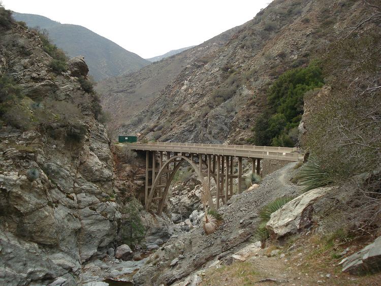
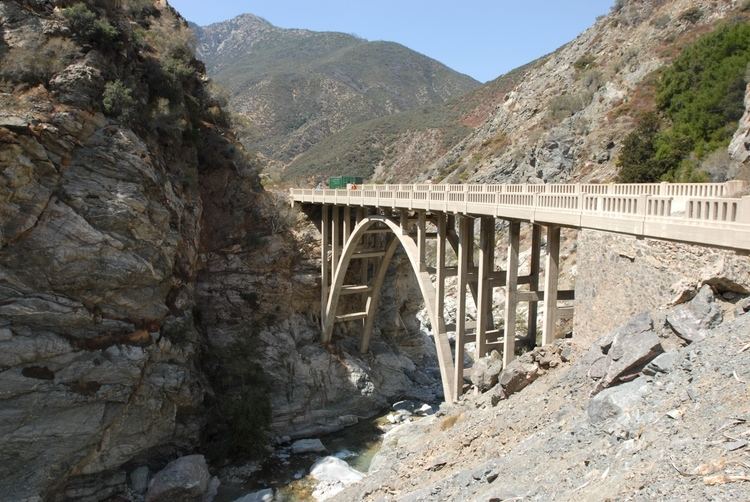
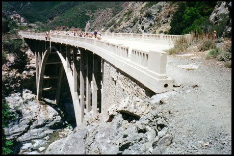
The Bridge to Nowhere is an arch bridge that was built in 1936 north of Azusa, California in the San Gabriel Mountains. It spans the East Fork of the San Gabriel River and was meant to be part of a road connecting the San Gabriel Valley with Wrightwood.
Contents
History
The East Fork Road was still under construction when it was washed out during the great flood of March 1–2, 1938. The East Fork Road project was abandoned as a result of the flood, leaving the bridge forever stranded in the middle of what is now the Sheep Mountain Wilderness.

Parts of the old asphalt roadway can still be found along the East Fork Trail which leads to the bridge, and there are still a number of concrete slabs which formed the foundations of destroyed bridges to the west of the Bridge to Nowhere. Indeed, the sign along the trail 30 feet east of the John Seals Bridge which announces the start of the Sheep Mountain Wilderness is resting on the old roadbed.
East Fork Trail
Currently there is a major rock fall at approximately 1.56 miles in along the trail at North 34 degrees 15.440, West 117 degrees 45.053, at 2271 feet altitude which poses a significant safety hazard to climb over. Additionally there is a cornice overhang remaining that is poised to come down and there is more friable San Gabriel granite to the right of the calving which is poised to come down. The United States Forest Service is looking at the problem with the San Gabriel Mountains Trailbuilders to determine what can be done about the hazard. As it is, safe passage through 50 meters of trail covered by the rock fall requires the crossing of the river two additional times.
The bridge is only accessible via a 10-mile round-trip hike or on horseback. Despite its popularity, the frequency with which the trails get washed out means that they are rough in places. The trail following the riverbed crosses the East Fork six times between the bridge and the trailhead. Generally, one follows the river up its course, with several stream crossings before the ascent to the level of the bridge.
The maintenance of the East Fork Trail which leads to the Bridge To Nowhere is the responsibility of the San Gabriel Mountains Trailbuilders volunteer organization which works under the supervision of the United States Forest Service. Typically trail repairs and maintenance are performed by the Trailbuilders during the Winter months when snow within the Crystal Lake Recreation Area makes trail working at higher elevations in the San Gabriel Mountains difficult and at times hazardous.
In addition to steps being carved out of rock faces to improve hiking safety, trail definition being improved through removing growth and rocks along the trail, and other typical trail work, the Trailbuilders also built the John Seals Bridge across Laurel Gulch, utilizing helicopters, horses, mules, and many human volunteers to establish concrete footings and assemble a solid wooden crossing to ensure safe passage across the Gulch.
Obstructions along the trail which leads to the Bridge To Nowhere and other significant trail problems can be reported to the Trailbuilders.
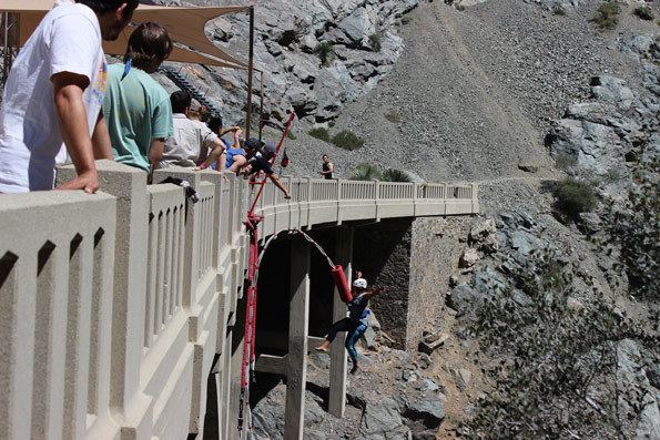
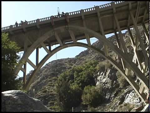
Bungee jumping
The bridge is a private inholding within the Angeles National Forest. Bungee jumping is provided by a private company. Jumpers typically meet at the main parking area for Heaton Flats Campground early in the morning, collecting at the Forest Service gate and then walking to the East Fork Trail trailhead where jumpers begin the hike generally as a group. After individuals jump from the bridge, people hike back either alone or in pairs or in groups, some times doing so after dark.
Safety issues
There have been a large number of fatalities along the East Fork of the San Gabriel River due in part to the swift water of the San Gabriel River which can rise significantly and without warning when heavy rainfall to the Northeast of the region introduces flash flood waters to the river. Crossing the river to and from the Bridge to Nowhere can be dangerous and even individuals crossing in groups have experienced fatalities.
Trail repair and reporting
Currently the San Gabriel Mountains Trailbuilders have repair and maintenance responsibility for the East Fork Trail from the Heaton Flats Campground, through the Sheep Mountain Wilderness, up to the foot of the bridge's leased land. Significant problems with the hiking trail which need to be addressed (dead trees blocking the trail, rock falls, extensive erosion) may be reported to the Trail Repairs web site, or they may be reported to the United States Forest Service by telephoning the San Gabriel River Ranger District.