
Local time Friday 10:00 AM | ||
 | ||
Weather 9°C, Wind S at 29 km/h, 98% Humidity | ||
Bridestowe primary is happy
Bridestowe is a civil parish and village in the district of West Devon, Devon, England. The parish is surrounded clockwise from the north by the parishes of Bratton Clovelly, Sourton, Bridestowe and Sourton Common, Lydford, Lewtrenchard and Thrushelton. In 2001 the population of the parish was 552, compared with 457 in 1901. There is an electoral ward with the same name; its population at the 2011 census was 1610.
Contents
Map of Bridestowe, Okehampton, UK
The village is 6 miles south-west of Okehampton on the edge of Dartmoor and on the A30 main road. It has a primary school, pre-school, village stores and post office, a number of public houses and accommodation providers, Methodist chapel and village hall.
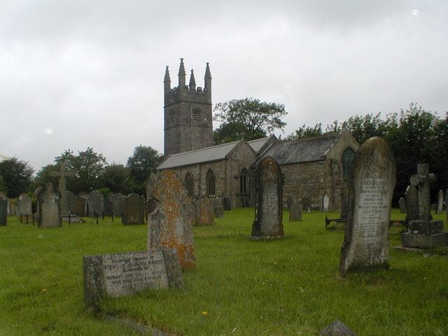
The parish church is mostly 13th and 15th century, with a west tower and some fragments of Norman work. It is dedicated to the Irish Saint Bride or Bridget, who is depicted in one of the stained glass windows, and from whom the place-name is derived.
Also within the parish are an Elizabethan mansion – Great Bidlake, and disused mine-workings which once produced lead and copper.
Bridestowe railway station was opened in 1874 and closed in 1968, together with the stretch of line from Okehampton station to Bere Alston.