
Prominence 176 First ascent ancestral Province Province of Genoa Easiest route Hiking | Elevation 1,107 m Range Apennine Mountains | |
 | ||
Similar Monte Reixa, Forte Geremia, Punta Martin, Monte Sciguello, Monte Rama | ||
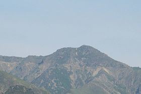
Bric del dente 11 gennaio 2015
Bric del Dente is a 1107 metres high mountain of the Apennines located in the Italian region of Liguria.
Contents
- Bric del dente 11 gennaio 2015
- Map of Bric del Dente 16010 Tiglieto Genoa Italy
- Masone bric del dente 1107 mt 26 marzo 2016
- Etymology
- Geography
- Environment
- Access to the summit
- Mountain huts
- References
Map of Bric del Dente, 16010 Tiglieto, Genoa, Italy
Masone bric del dente 1107 mt 26 marzo 2016
Etymology
Bric in Ligurian means hill or mountain, while dente in Itailan means tooth.
Geography
The mountain stands on the Adriatic / Ligurian drainage divide between Passo del Faiallo and Passo del Turchino. It belongs to the province of Genoa, in Liguria. Its summit is a tripoint at which the valleys of Cerusa, Orba and Stura di Ovada meet. Sella Bernè (894 m) divides Bric del Dente from the neighbouring Monte Giallo (at East, 969 m), while a saddle at 931 m divides it from Monte Reixa (westwards, 1183 m). The top of the mountain is marked by a memorial pillar ovelooked by a small summit cross.
Environment
Bric del Dente sides are generally rocky and steep save the south-western one, gentler and grassier.
Since 1985 the mountain belongs to the Parco naturale regionale del Beigua.
Access to the summit
The mountain is easily accessible by signposed traks departing from Sella Bernè, Passo del Faiallo or Masone.
The Alta Via dei Monti Liguri, a long-distance trail from Ventimiglia (province of Imperia) to Bolano (province of La Spezia), passes very close to the mountain's summit.