
Country Canada Census division 11 Time zone MST (UTC-7) Area 173 ha Local time Thursday 10:22 PM | Postal code span T0C 0P0 Population 574 (2016) Province Alberta | |
 | ||
Weather -3°C, Wind S at 11 km/h, 67% Humidity | ||
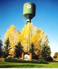
Breton /ˈbrɛtən/ is a village in central Alberta, Canada. It is located roughly 95 kilometres (59 mi) southwest of Edmonton.
Contents
Map of Breton, AB, Canada
History
Originally called Keystone, it was established in 1909 by a group of African-American immigrants as a block settlement. The new Black Canadian homesteaders arrived from Oklahoma and Texas, just four years after Alberta became a province in 1905.
In 1927 the town was re-named after politician Douglas Breton, in his second year as the region's Member of the Alberta Legislature.
Infrastructure
It has one High School (grades 7-12) and one elementary (K-6) school. It has a volunteer fire department, two grocery stores, two golf courses, four restaurants, two hair parlors, a police station with three officers and one secretary.
Demographics
In the 2016 Census of Population conducted by Statistics Canada, the Village of Breton recorded a population of 574 living in 252 of its 292 total private dwellings, a 7001157000000000000♠15.7% change from its 2011 population of 496. With a land area of 1.72 km2 (0.66 sq mi), it had a population density of 333.7/km2 (864.3/sq mi) in 2016.
The Village of Breton's 2012 municipal census counted a population of 581, a 0.3% increase over its 2007 municipal census population of 579.
In the 2011 Census, the Village of Breton had a population of 496 living in 208 of its 218 total dwellings, a -9.8% change from its 2006 population of 550. With a land area of 1.73 km2 (0.67 sq mi), it had a population density of 286.7/km2 (742.6/sq mi) in 2011.
In 2006, Breton had a population of 550 living in 243 dwellings, a 4.0% decrease from 2001. The Village has an area of 1.73 km2 (0.67 sq mi) and a population density of 317.7 inhabitants per square kilometer.