
Elevation 2,017 m | Prominence 310 m | |
 | ||
Similar Lodalskåpa, Kjenndalskruna, Tverrådalskyrkja, Snøholstinden, Kvitskardtinden | ||
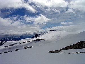
Brenibba is a nunatak protruding from the north end of the Jostedalsbreen glacier in the Breheimen mountain range. It is located in the municipality of Luster in Sogn og Fjordane county, Norway. Brenibba is 2.5 kilometres (1.6 mi) south of Lodalskåpa and 12 kilometres (7.5 mi) northeast of Høgste Breakulen. It is part of the Jostedalsbreen National Park. The lakes Austdalsvatnet and Styggevatnet are located 11 kilometres (6.8 mi) west of Brenibba.
Contents
Map of Brenibba, 6871 Jostedal, Norway
Name
The first element is bre which means "glacier" and the last element is the finite form of nibbe which means "mountain peak".
References
Brenibba Wikipedia(Text) CC BY-SA