
County Lehigh Area code(s) 610 & 484 Zip code 18031 Population 4,138 (2010) | Time zone Eastern (EST) (UTC-5) Elevation 130 m Local time Thursday 9:43 PM Number of airports 1 | |
 | ||
Weather 2°C, Wind W at 18 km/h, 42% Humidity Area 8.366 km² (8.34 km² Land / 3 ha Water) | ||
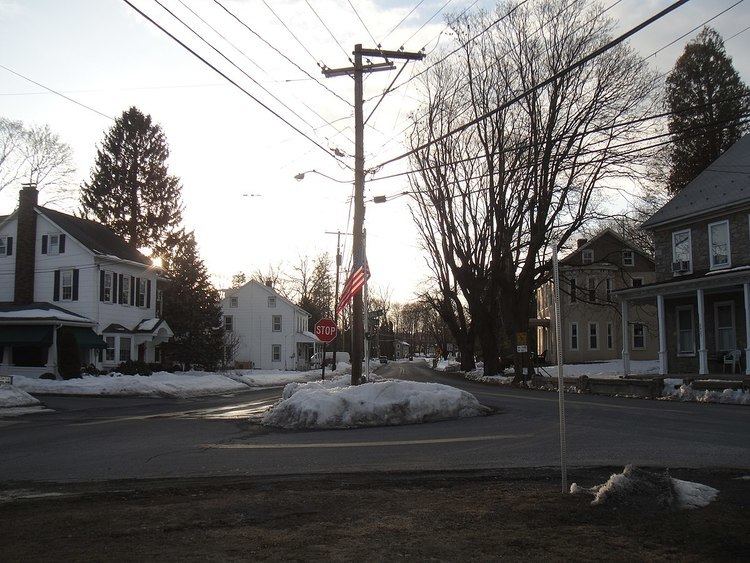
Breinigsville is a census-designated place located in Lehigh County, Pennsylvania, in the United States. The town is part of Upper Macungie Township, approximately 11 miles (18 km) southwest of Center City Allentown and 7 miles (11 km) east of Kutztown, Pennsylvania.
Contents
- Map of Breinigsville PA USA
- History
- Demographics
- Topography
- Surrounding municipalities
- Climate
- Public education
- Economy
- Police and fire
- Recreation
- In popular culture
- References
Map of Breinigsville, PA, USA
History
Breinigsville was named for George Ludwig Breinig (January 31, 1733 – May 12, 1812), a German immigrant who came to America on board the ship Lydia, arriving in Philadelphia on October 13, 1749. He originally settled in Weisenberg Township (tax records show he was assessed 9 pounds in 1762). On May 10, 1771, Breinig purchased around 100 acres (40 ha) of land and a stone dwelling for 700 pounds from Peter and Catherine Trexler (of "Trexlertown") along "the great road leading to Philadelphia".
He resided on that land until his death. Breinig was one of the judges of the election at Allentown, on July 8, 1776, when delegates to the first constitutional convention of the state were elected. During the Revolutionary War, Breinig became the colonel of the Second Battalion of Northampton county militia. In 1786, he was commissioned a justice of the district of Macungie and Weisenberg townships. Breinig is buried at Zion Lehigh Lutheran Church, Alburtis.
Among his seven children was Peter Breinig, the youngest son, and the founder of Breinigsville, who owned a 123-acre (50 ha) farm. He built a tavern in the village and operated it for some years. As in most early towns, the tavern served as the center of the community. Today, the tavern is in the location of the Breinigsville Hotel.
In the early 1800s, the village was a center for the mining of iron ore, furnishing employment to many men. Around 1855, the Allentown Railroad was graded through Breinigsville, but the tracks were never laid. In the 1860s, the Catasauqua and Fogelsville Railroad used the grade to build from Trexlertown, on its main line, into Breinigsville, as part of a branch to serve local limonite (iron ore) mines. The largest deposit of pyrite ore in the region was located 2 miles northwest of Breinigsville. Later, the village was served by the Allentown-Reading Traction Company. These mines had shut down by the end of World War I, and the rails through Breinigsville were consequently abandoned. They were finally removed in the 1940s.
On the western edge of Breinigsville, a United Brethren Church was built in 1880 whose membership at one time peaked at around 40. Regular services discontinued in 1912.
At one time, the village had a lumber, grain, and coal depot, a carriage works, and a general store, which are no longer in existence. In the mid-1800s, a two-room school house was built in the town, with the upper grades taught by Miss Edith Walbert and the lower grades taught by Mr. John Shoemaker. While the school has long ceased operations, the building still stands. Around 1860, an independent school district was formed in the township by an act of the legislature. The single school replaced the dozens of smaller schools, including the one in Breinigsville. The school district served until the early 1900s, when the Parkland School District was formed.
In 1987, AT&T acquired around 137 acres in Breinigsville which became to be known as TEK Park Campus. The facility became Bell Labs' world headquarters for optoelectronics research. In the late '90s, the center was spun off as Lucent Technologies. In 2002, it was spun off again as Agere Systems. In 2003, the park was sold to TriQuint Semiconductor. In 2012, TEK Park was sold to MRA Group for $50 million.
Demographics
As of the 2010 census, Breinigsville consists of 51.11% females and 48.89% male. The population is made of 79.92% White Non-Hispanic, 5.24% Black or African American, 0.48% Native American or Alaskan Native, 11.07% Asian, 0.0% Native Hawaiian, 1.55% were two or more races, and 1.74% were some other race. Of the population 7.08% were of Hispanic or Latino ancestry.
The town has a population of 4,138 with a median age of 34.6. The largest age groups are 19.21% (5–17), 17.97% (25–34), 16.24% (35–44), and 12.87% (45–54). Breinigsville has 1,550 households made of 1,112 families and 438 non-family households. The average is 2.67 individuals per household and 3.16 individuals per family. Additionally, with 1,677 total housing units, 1,550 are occupied and 127 are vacant. 91.2% of households are owner-occupied and 2.34% rent.
Topography
Breinigsville is located at 40°32'12" North, 75°37'53" West (40.5367627, -75.6312997). Elevation is 427 feet (130 m). Schaefer Run flows east through the village into the Little Lehigh Creek.
Surrounding municipalities
Breinigsville is located along U.S. Route 222, between its intersection with the southern terminus of Pennsylvania Route 863 and Route 222's Trexlertown Bypass (Fred Jaindl Memorial Highway). The town of Breinigsville is located between Trexlertown and Maxatawny.
Climate
Breinigsville lies within the humid continental climate zone (Köppen: Dfa ), and experiences four distinct seasons. Summers are hot and humid, with a July daily average of 83 °F (28.3 °C). In a normal summer, temperatures exceed 85 °F (29 °C) on 15 days. Winters are cold and snowy with few sunny days, and with a January daytime average high of 34 °F (1.1 °C). Spring and autumn are mild seasons with low humidity.
Public education
Breinigsville is served educationally by Parkland School District. The district has one high school, Parkland High School (for grades nine through 12), two middle schools Springhouse Middle School and Orefield Middle School (for grades six through eight), and eight elementary schools (for kindergarten through fifth grade), Cetronia Elementary School, Fogelsville Elementary School, Ironton Elementary School, Fred J. Jaindl Elementary School, Kernsville Elementary School, Kratzer Elementary School, Parkway Manor Elementary School, and Schnecksville Elementary School. Elementary students from the Breinigsville area attend Fogelsville or Jaindl while its middle-school students attend Springhouse.
The Fred J. Jaindl Elementary School, which opened fall of 2010, is located in Breinigsville.
Economy
Throughout the 19th century, the economy of Breinigsville was primarily agriculture and mining. A number of large mines existed; the mines and later the train tracks were abandoned. In the early 1900s the town was transformed into a mainly agriculture-based economy. Toward the late 1970s and 80s due to relatively cheaper land prices and close proximity to New York, a number of major distributors and warehouses have relocated to the area. Large facilities and distribution centers in Breinigsville include ShopRite, Olympus, Home Depot, Uline, Niagara Bottling and Nestle/Deer Park Water Bottling Plant. In 2009, Nestlé Waters renovated their facility to become LEED Gold certified. Some warehouses, particularly Amazon's, have been criticized in the local press for dangerous working conditions. In March 2014, the Supreme Court agreed to hear the case that involves Amazon's warehouse in Breinigsville.
A number of large book publishing companies also operate from Breinigsville. Amazon's distribution warehouse is situated in Breinigsville. RR Donnelley is also located in the town. In 2007, Lightning Source opened a new 130,000sq feet printing and distributing facility in Breinigsville. Cyclocross Magazine also operates from Breinigsville.
The corporate headquarters of Buckeye Partners is based in Breinigsville.
Agriculturally, the town is still the home to a number of nurseries and greenhouses operated by small business. Grim's Greenhouse is located in Breinigsville. The town has a number of large vineyards. Clover Hill Vineyards & Winery as well as Vynecrest Vineyard & Winery are located in Breinigsville; the town is also the home to a major Samuel Adams brewery.
Police and fire
Prior to 2013 Breinigsville was served by the Berks-Lehigh Regional Police, which was a multi-jurisdictional police department. The department is now defunct.
Effective December 31, 2012, Upper Macungie Township Police Department serves the town. The department is located at 37 Grim Road, Breinigsville, PA. 18031.
Breinigsville is served by three fire departments:
Recreation
Terry Hill Waterpark and Campgrounds, a 43-acre (0.17 km2; 0.067 sq mi) waterpark, is located in Breinigsville. As of January 2010, the waterpark was shut down and available for purchase, while the adjacent trailer park remained in operation.
Breinigsville has a number of neighborhood parks and playgrounds. Breinigsville Park is located in the center of Breinigsville. That park, 24.3-acre (0.098 km2; 0.0380 sq mi), has 2⁄3 mile of paved walking/cycling paths. Additionally, it offers a Baseball and Softball fields, Basketball and a Sand volleyball court. The park hosts a large fireworks show every year on Independence Day.
Though it is widely thought to be in Trexlertown, as evidenced by its nickname "T-Town", the Lehigh Valley Velodrome is actually located in the Breinigsville section of the township. It is one of the most well known cycling stadiums in the country and attracts cyclists from all over the world.
In popular culture
In 2004, then-president George W. Bush made an unannounced stop at the Home Town Diner in Breinigsville, PA.
In 2012, an entire episode of 30 Minute Meals featuring Rachael Ray and Regis Philbin was filmed from the home of a couple from Breinigsville.