
Population 83,877 (2010) | Time zone CST (UTC-6) Area code 417 | |
 | ||
Weather 12°C, Wind W at 10 km/h, 23% Humidity Area 3,010 km² (2,836 km² Land / 173.5 km² Water) | ||
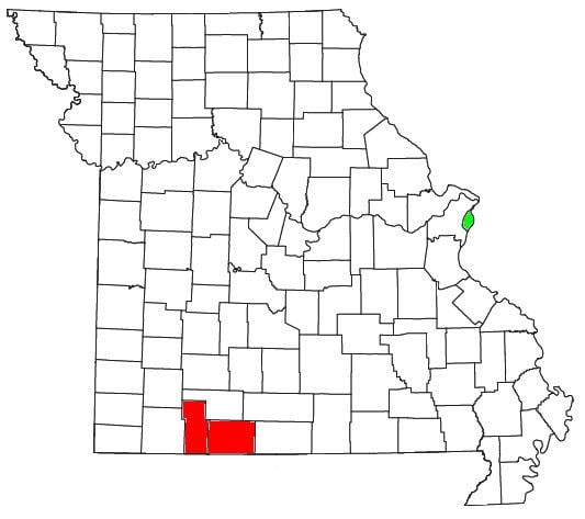
The Branson Micropolitan Statistical Area, as defined by the United States Census Bureau, is an area consisting of two counties in southwestern Missouri, anchored by the city of Branson. After the 2012 estimates the Branson Micropolitan area is part of the Springfield Combined Metropolitan area.
Contents
- Counties
- Places with more than 10000 inhabitants
- Places with 1000 to 5000 inhabitants
- Places with less than 1000 inhabitants
- Demographics
- References
As of the 2010 census, the μSA had a population of 83,877.
Counties
Places with more than 10,000 inhabitants
Places with 1,000 to 5,000 inhabitants
Places with less than 1,000 inhabitants
Demographics
As of the census of 2000, there were 68,361 people, 27,980 households, and 19,894 families residing within the μSA. The racial makeup of the μSA was 96.82% White, 0.23% African American, 0.76% Native American, 0.28% Asian, 0.05% Pacific Islander, 0.54% from other races, and 1.33% from two or more races. Hispanic or Latino of any race were 1.84% of the population.
The median income for a household in the μSA was $31,768, and the median income for a family was $36,801. Males had a median income of $25,828 versus $19,423 for females. The per capita income for the μSA was $17,652.