Topo map OS Landranger 36, 43 Prominence 461 m | OS grid NN953999 Elevation 1,296 m | |
 | ||
Translation Brindled greyish upper part (Gaelic) Pronunciation Scottish Gaelic: [əm ˈpɾaːj ˈrˠiəvəx] Similar Cairn Toul, Ben Macdui, Sgòr an Lochain Uaine, The Devil's Point, Sgòr Gaoith | ||
Cairngorms braeriach aviemore and the monadhliath mountains from creag a chalamin may 2014
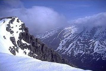
Braeriach (Scottish Gaelic: Bràigh Riabhach/Am Bràigh Riabhach) is the third-highest mountain in the British Isles, surpassed only by Ben Nevis and Ben Macdui. It is the highest point in the western massif of the Cairngorms, separated from the central section (containing Ben Macdui and Cairn Gorm) by the pass of the Lairig Ghru. The summit has a crescent shape, with several corries. In the north-facing corrie of Garbh Coire Mor the snow has completely melted just 5 times in the last century: 1933, 1959, 1996, 2003 & 2006 and the patches that linger there are the longest-lying snow patches in Scotland.
Contents
- Cairngorms braeriach aviemore and the monadhliath mountains from creag a chalamin may 2014
- Map of Braeriach Aviemore UK
- References
Map of Braeriach, Aviemore, UK
Probably the most commonly used route up Braeriach starts from Sugar Bowl car park, on the road leading the Cairn Gorm ski area. From here a path leads over the hillside to a steep-sided rocky ravine known as the Chalamain Gap, before descending around 100 metres to the Lairig Ghru. After crossing this pass the route heads for the summit via Braeriach's north ridge, crossing a subsidiary peak, Sròn na Lairige. The summit is about 9 km from the car park by this route.
