Topo map OS Landrangers 36, 43 Prominence 118 m | OS grid NN954976 Elevation 1,258 m | |
 | ||
Translation peak of the green lochan (Gaelic) Pronunciation Scottish Gaelic: [ˈs̪kɔɾ ə ˈlˠ̪ɔxɛɲ ˈuəɲə] Similar | ||
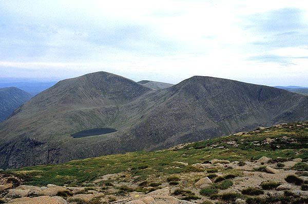
Sgòr an Lochain Uaine is a mountain in the Cairngorms, Scotland. By some counts it is the fifth highest mountain in Scotland (and the United Kingdom). It is the third highest point in the western massif of the Cairngorms, lying between Braeriach and Cairn Toul on the western side of the pass of the Lairig Ghru. It was only "promoted" to Munro status by the Scottish Mountaineering Club's 1997 revision of the tables.
Contents
Map of Sg%C3%B2r an Lochain Uaine, Ballater, UK
Sgòr an Lochain Uaine is a remote mountain, and all routes to the summit are long days by Scottish standards. It is usually climbed in conjunction with other peaks: if coming from the south it may be combined with Cairn Toul and The Devil's Point, whilst from the north one must first cross Braeriach.
Name
The mountain takes its named from An Lochan Uaine the Lochan lying in the corrie on the north-east side of the peak. It is known by some as, and the Ordnance Survey maps show, The Angel's Peak, but that name is a 19th-century invention ; invented as a counterpoint to The Devil's Point nearby.
