
Country United States of America Types of rock Granite, Schist | Elevation 7,979 ft (2,432 m) Highest point Mount Union Mountains Mount Union | |
 | ||
Length 40 mi (64 km) north-south Borders on Weaver Mountains-WSierra Prieta-NWBlack Hills (Yavapai County)-NE & ENew River Mountains-SE | ||
The Bradshaw Mountains (Yavapai: Wi:kañacha, "rough, black range of rocks") are a mountain range in central Arizona, United States, named for brothers Isaac and William Bradshaw after their death, having been formerly known in English as the Silver Mountain Range.
Contents
- Map of Bradshaw Mountains Arizona 86333 USA
- HistoryEdit
- GeographyEdit
- PeaksEdit
- GeologyEdit
- EcologyEdit
- Human useEdit
- Ghost towns and other settlementsEdit
- Protected areasEdit
- References
Map of Bradshaw Mountains, Arizona 86333, USA
HistoryEdit
The first known settlements in the Bradshaws were a group of Yavapai people, called the Kwevkapaya who built forts and mined copper from around AD 1100 to 1600. Apaches occupied the area around 1800 as a means of keeping White settlers out. But by 1863, a party led by William Bradshaw was in the area, followed by the Walker party. In 1864, a group of five white settlers was attacked by Apaches at what is now called Battle Flat. One of the settlers went for help, but upon his return found the Apaches had left. The Walker party found gold, and within a few years, the Bradshaws were filling up with settlers mining for gold, silver, and copper. In the early part of the 20th century, most of the towns that had sprung up were little more than ghost towns.
GeographyEdit
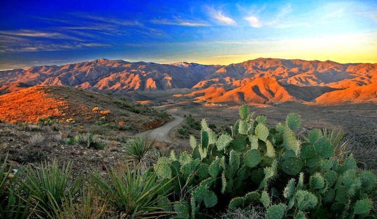
Located approximately 5 miles (8 km) south of Prescott, Arizona, between the Agua Fria River on the east, and the Hassayampa River on the west, the range is 40 miles (64 km) long, and almost 25 miles (40 km) wide.
PeaksEdit
GeologyEdit
The Bradshaw Mountains consist primarily of Precambrian granite, gneiss and schist.
EcologyEdit
The biotic community of the Bradshaws ranges from interior chaparral and montane conifer forest, to plains and desert grassland, and Sonoran desert scrub. Many species of trees are found in the Bradshaws, including Piñon, Alligator Juniper, Ponderosa pine, Blue Spruce, Quaking Aspen, White fir, and Douglas fir. As well, much wildlife is present, including javelina, mountain lion, bobcat, black bear, mule deer, porcupine, fox, skunk, rock squirrel, wild turkey, many species of reptiles and amphibians, and many species of birds.
Several creeks have been dammed to form reservoirs, including Lynx Lake, Goldwater Lake, Lake Marapai, Hassayampa Lake, Horsethief Lake, and Cedar Tank.
Human useEdit
Gold was first discovered in the Bradshaws in the 1863, over $2,000,000 worth being taken from just the Crown King Mine. Copper and silver were also mined in the early part of the 20th century.
Ghost towns and other settlementsEdit
There are over 40 ghost towns in the Bradshaw Mountains, including Crown King, Bumble Bee, Goodwin, Bradshaw City, Alexandra and Cleator.
Protected areasEdit
Much of the Bradshaw Mountains are on Prescott National Forest land. Other parks include Horsethief Basin Recreational Area, Lynx Lake Recreational Area, and the Castle Creek Wilderness.