
Prominence c. 205 m OS grid SC193711 Elevation 230 m | Topo map OS Landranger 95 Listing Marilyn | |
 | ||
Similar Mull Hill, Milner's Tower, Calf of Man, Spanish Head, South Barrule | ||
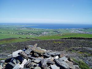
Bradda Hill (Manx: Cronk Vradda) is a headland some 2 kilometres (1.2 mi) north of the village of Port Erin on the Isle of Man. It is not to be confused with Bradda Head which is about 2 kilometres (1.2 mi) to the SW.
Map of Bradda Hill, Isle of Man
The path to the summit from Bradda West is part of the Raad ny Foillan, the Isle of Man Coast long distance footpath. Cliffs drop from the summit down to the sea. It shelters Fleshwick Bay from the west. A gorse fire in October 2003 took two days to control, five days to die, and scarred Bradda Hill and other headlands around Fleshwick.
References
Bradda Hill Wikipedia(Text) CC BY-SA