
Community Toronto | ||
 | ||
Restaurants The Stockyards, Ferro Bar Café, Dutch Dreams, Baker and Scone, Cho Cho Cho | ||
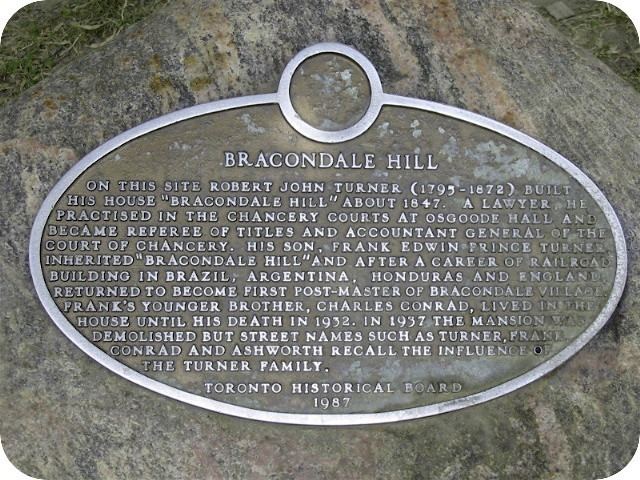
Bracondale Hill, also known as Hillcrest, is an upper-middle-class neighbourhood located in Toronto, Ontario, Canada. Annexed by the old City of Toronto in 1909 and developed in 1911 from the Turner estate, Bracondale Hill is in the western end of midtown Toronto and stretches above Davenport Road and below St. Clair Avenue West. The area is home to mostly large, early-20th-century, single-family homes surrounding Hillcrest Park that overlook the city. Many multicultural restaurants and shops are located nearby on St. Clair West to the north, and on Davenport Road/Ossington Avenue to the southwest of the neighbourhood.
Map of Bracondale Hill, Toronto, ON, Canada
Its main commercial shopping area is along St. Clair Avenue. It has several main streets: Bathurst Street, a four-lane arterial road running north-south on the east; St. Clair Avenue, a four-lane arterial road, with streetcar right-of-way, on the north running east-west; and Davenport Road running east-west to the south.
In the eastern section at Bathurst and Davenport is the Wychwood Park enclave. From 1926 to 1967, a part of this area was represented by the Bracondale constituency in the Ontario Legislative Assembly.